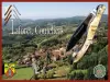
Le Brugeron is a commune in the Puy-de-Dôme department, in the Auvergne-Rhône-Alpes region, 25 km north of Ambert by road.
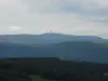
Bordering the Loire department to the east, its territory of 27 km² belongs to the Livradois natural region and ranges from 671 to 1427 m altitude, on the slopes of Forez, to the east and to the south.
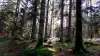
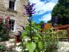
Dominated by a ridge stretching from the Col de la Loge (1243 m) in the northeast to the Pas de la Croix in the southeast, crossed by the La Faye and Gerize streams which descend from the Forézian mountains, the mid-mountain locality has retained a rural and green environment. It is covered mainly by beech and conifer forests (75.1% of its surface area) and meadows (11.6%).
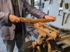
Formed during the Revolution, the commune relied until the 20th century on an economy linked to the production of cheeses (fourme des Monts du Forez) thanks to its high altitude pastures (jasseries) and the exploitation of wood (manufacture of clogs and boards dedicated to shipbuilding).
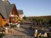
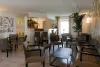
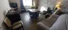
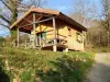
Nowadays, it also relies on tourism (establishment of campsites and hotels) linked to its preserved nature and its potential in terms of hiking, in particular. Le Brugeron (nearly 250 inhabitants) is waiting for you!
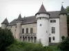
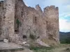
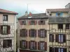
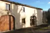
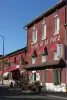
In the village which developed in the 19th century and some hamlets, several heritage elements are worth the detour.
It is therefore appropriate to mention the Saint-Jean Baptiste church, rebuilt from 1856 to replace a Romanesque chapel. In neo-Gothic style, the building has an elongated plan which ends in a semi-circular apse. Its facade, to the west, is in the form of a bell tower-porch with a pointed arch portal. We notice two hexagonal turrets on the sides. Inside, the nave is covered by a semi-circular barrel vault.
The church has the specificity of housing three harmoniums.
Also worth seeing is the war memorial surrounded by an ornate grille: the crosses which adorned it were stolen the day before its inauguration in 1921 by supporters of secularism.
Several fountains, built in the last third of the 19th century and the beginning of the 20th century, as well as bridges, most of them renovated, still mark the village and the localities.
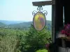
Then it's time for leisure activities linked to the green environment of Brugeron. Hikers are obviously celebrating! The most famous route in the area is that leading to the summit of Puy Gros: departure from the church towards the south of the town, a 4.5 hour walk for a 16 km loop and a difference in altitude of more than 600 m. The route is punctuated by paved paths bordered by granite walls, "jasseries" (meadows and high altitude shelters) on the plateaus and foothills of Forez and magnificent viewpoints.
Other circuits are obviously accessible, which can "spill over" into neighboring localities, dedicated to the discovery of forests, small rural heritage or even rich biodiversity.
For mountain bikers, the town is on one of the sections of the “Tour du Livradois-Forez” which offers a total of 223 km of route (i.e., for the most experienced, 5 to 7 days of hiking made up of 14 stages on secure routes).
For hikers, maps and information from the intercommunal tourist office on +33 4 73 80 64 48.
In winter, around the Col du Béal, which covers part of the south of the territory, routes dedicated to cross-country skiing enthusiasts or snowshoe hikes are available depending on snow conditions. Information from the Foyer de ski du Brugeron on +33 4 73 72 09 37.
In another register, for hunters, the Camelot park offers training sessions for dogs and dog hunting courses in a wooded environment. wild boar with a bow or rifle. Contact on +33 6 11 15 06 30.
Throughout the year, activities (thematic hikes, workshops, conferences, exhibitions) are scheduled by the Livradois-Forez Regional Natural Park of which the municipality is a member: contact +33 4 73 95 57 57.