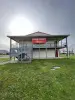
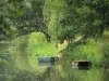
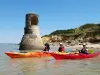
Pole nature of the Marais Poitevin: museum and interpretive trail. Information +33 5 46 56 34 46.

Favourite
| Municipality | Taugon |
|---|---|
| Postcode | 17170 |
| Latitude | 46.2999975 (N 46° 17’ 60”) |
| Longitude | -0.8333327 (W 0° 49’ 60”) |
| Altitude | From 1m to 8m |
| Surface area | 15.70 km² |
| Population | 793 inhabitants |
| Density | 50 inhabitants/km² |
| Prefecture | La Rochelle (34 km, 38 min) |
| Insee code | 17439 |
| Intercommunality | CC Aunis Atlantique |
| Department | Charente-Maritime |
| Territory | Charentes |
| Region | New-Aquitaine |
| La Ronde | 4.3 km (9 min) |
|---|---|
| Saint-Jean-de-Liversay | 6.7 km (9 min) |
| Saint-Cyr-du-Doret | 8.3 km (12 min) |
| Vix | 9.1 km (12 min) |
| Courçon | 10 km (12 min) |
| Maillé | 11.2 km (14 min) |
| Doix lès Fontaines | 12.6 km (16 min) |
| Ferrières | 13 km (15 min) |
| Saint-Sauveur-d'Aunis | 13.3 km (16 min) |
| Maillezais | 13.7 km (16 min) |
| Damvix | 14.1 km (19 min) |
| Le Gué-de-Velluire | 14.7 km (19 min) |
| La Grève-sur-Mignon | 15.4 km (19 min) |
| Le Gué-d'Alleré | 15.7 km (17 min) |
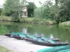
Pole nature of the Marais Poitevin: museum and interpretive trail. Information +33 5 46 56 34 46.
First Saturday in July: Hiking semi-nocturnal.
Second Sunday of September: flea market garage sale.
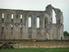
3rd Sunday of September: Pilgrimage to Our Lady of Sorrows (for over 150 years).

| Last name | Activity type | Rate | City |
|---|---|---|---|
 | Nature and the great outdoors | 175 € to 1035 € | Sainte-Hermine (33 km) |
 | Sports sensations | 14 € to 55 € | Fouras (40 km) |
 | Sports sensations | 275 € | Marennes-Hiers-Brouage (47 km) |
| Last name | Outing type | Difficulty | Duration | Departure municipality |
|---|---|---|---|---|
 | Hike | Easy | 1:05 | Le Gué-de-Velluire (10.8 km) |
 | Hike | Easy | 1:00 | La Taillée (11.5 km) |
 | Hike | Easy | 1:05 | La Taillée (11.5 km) |
 | Hike | Easy | 4:55 | Sainte-Radégonde-des-Noyers (18.8 km) |
 | Hike | Intermediate | 3:45 | Saint-Michel-le-Cloucq (21 km) |