Roquefeuil is a town in Aude, in the Occitanie region, 24 km southwest of Quillan by road.
Its territory of 22 km² oscillates from 834 to 1180 m of altitude, and it is located within the Pays de Sault, a former viscount covering a granite plateau at the foot of the peaks of the Pyrenees.
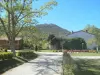
Bordering the Ariège department to the north-west, the locality crossed by the road linking Quillan to Ax-les-Thermes has retained a very green landscape, covered with forests and natural grassy environments (55% of its area), meadows (22%) and agricultural areas (21%).
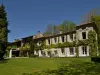
The village developed after the year 1000 in a plain below a castle that became a royal fortress after the crusade against the Albigenses. Tried by the conflicts, Roquefeuil which presented the characteristics of a country house was redeveloped after Spanish incursions in the 16th and 17th centuries.
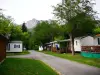
Composed of a town and several hamlets, the town has paid a heavy price for the rural exodus (there are nearly 300 inhabitants there, whereas it once counted a thousand). Its heritage and its leisure activities in the heart of the Aude Pyrenees now make it a popular stopover for hikers and lovers of green tourism at the foot of the peaks of the Pyrenean chain.
In terms of heritage, the parish church of Saint-Jean-Baptiste is the jewel of Roquefeuil. Listed in the Inventory, it dates from 1540, having been erected in the center of the village to survive in a primitive building located near the old castle (a cross continues to indicate its location). Its single nave is framed by eight side chapels and one can also observe that the choir is vaulted via ribs. It houses a 17th century altarpiece. The bell tower in the form of a square tower and the porch on the west side are remarkable. The latter in fact protects a portal in a broken arch with beautifully sculpted decorations (columns, capitals).
The old chapel of Saint-Roch, the hamlet of Benague are other sites of interest, without forgetting the rare remains of the medieval castle and the beautiful central square of Roquefeuil with its washhouse at the origin of the astonishing legend of the Mare aux Fées (linked to the cleaning of the sheets of the victims of a cholera epidemic in the middle of the 19th century and which the washerwomen passed on for decades).
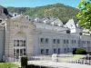
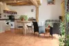
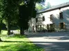
Away from the small town, a visit to the Maison de la Montagne is a must. This space houses an inter-municipal media library, and it hosts exhibitions. There is also a "service point" and a shop dedicated to local products. Finally, an annex to the Quillan tourist office is open from mid-June to mid-September. Contact on +33 4 68 20 07 78.
Lastly, and above all, the locality is renowned and appreciated for its potential in terms of hiking. A route leads to the Pic des Sarrasis, to the south-west of the village, which rises to 1180 m. At the foot of this summit, there is a so-called Postman's cross engraved with the name of Baptiste Artigues, who froze to death during his tour in January 1871…
Other loops are dedicated to the discovery of the natural heritage: Roquefeuil counts indeed an area classified "Natura 2000" because of the number of birds that have their habits (vultures, passerines such as ortolans or larks, black woodpeckers) and three sensitive and protected areas: the forest of Sainte-Colombe, the forest of Bac d'en Filla and the Pinet peat bog…
Finally, larger routes dotted with exceptional panoramas - but sometimes presenting difficulties for the uninformed public - can lead in particular to the Pic du Midi.
Maps and information on +33 4 68 20 75 89 or +33 4 68 20 07 78.
The third weekend of August, communal feast with local meals, concerts, balls and garage sale.