

Favourite
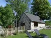
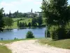
Évaux-les-Bains
| Municipality | Mazirat |
|---|---|
| Postcode | 03420 |
| Latitude | 46.2243300 (N 46° 13’ 28”) |
| Longitude | 2.5405220 (E 2° 32’ 26”) |
| Altitude | From 259m to 495m |
| Surface area | 20.26 km² |
| Population | 291 inhabitants |
| Density | 14 inhabitants/km² |
| Prefecture | Moulins (88 km, 1:26) |
| Insee code | 03167 |
| Intercommunality | CA Montluçon Communauté |
| Department | Allier |
| Territories | Auvergne, Bourbonnais, Massif Central |
| Region | Auvergne-Rhône-Alps |
| Sainte-Thérence | 4.5 km (7 min) |
|---|---|
| La Petite-Marche | 5.6 km (10 min) |
| Teillet-Argenty | 6.7 km (10 min) |
| Terjat | 7.4 km (11 min) |
| Saint-Genest | 8.6 km (13 min) |
| Chambonchard | 9.5 km (16 min) |
| Évaux-les-Bains | 10.6 km (15 min) |
| Budelière | 11.3 km (14 min) |
| Lignerolles | 11.6 km (16 min) |
| Marcillat-en-Combraille | 12.4 km (18 min) |
| Arpheuilles-Saint-Priest | 12.5 km (19 min) |
| Saint-Julien-la-Genête | 13.6 km (20 min) |
| Prémilhat | 14.1 km (17 min) |
| Villebret | 14.5 km (20 min) |
| Last name | Activity type | Rate | City |
|---|---|---|---|
 | Nature and the great outdoors | 7 € | Chapdes-Beaufort (44 km) |
| Last name | Outing type | Difficulty | Duration | Departure municipality |
|---|---|---|---|---|
 | Car itinerary | Easy | 1:35 | Évaux-les-Bains (6.8 km) |
 | Hike | Intermediate | 2:20 | Évaux-les-Bains (6.9 km) |
 | Hike | Easy | 2:00 | Évaux-les-Bains (7 km) |
 | Hike | Easy | 2:00 | Chambon-sur-Voueize (9.6 km) |
 | Village visit | Easy | 1:00 | Servant (31 km) |