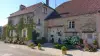
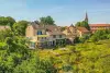
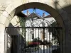
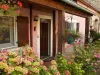
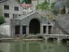
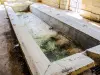
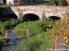
Liven up your holidays!

Larret

Tourism, holidays & weekends guide in the Haute-Saône

Larret - Tourism, holidays & weekends guide in the Haute-Saône
8.5
5

Geographical information

MunicipalityLarret
Postcode70600
Latitude47.6265209 (N 47° 37’ 35”)
Longitude5.6299970 (E 5° 37’ 48”)
AltitudeFrom 229m to 347m
Surface area5.58 km²
Population60 inhabitants
Density10 inhabitants/km²
PrefectureVesoul (54 km, 51 min)
Insee code70297
IntercommunalityCC des Quatre Rivières
DepartmentHaute-Saône
TerritoryFranche-Comté
RegionBurgundy-Franche-Comté

Nearest cities & towns

Courtesoult-et-Gatey1.3 km (2 min)
Pierrecourt3.8 km (4 min)
Argillières4.8 km (8 min)
Fouvent-Saint-Andoche5.3 km (10 min)
Achey6.8 km (11 min)
Delain7.1 km (12 min)
Roche-et-Raucourt7.1 km (10 min)
Gilley8.5 km (15 min)
Volon8.7 km (12 min)
Vaite8.8 km (10 min)
Valleroy9.1 km (14 min)
Framont9.2 km (12 min)
Montot9.3 km (15 min)
Champlitte-la-Ville9.9 km (13 min)

Photos

Larret, seen from the Vaite road (© JE)
See photo
Church of the Assumption in Larret (© JE)
See photo
Larret wash basin (© JE)
See photo
Old castle of Larret (© JE)
See photo
Larret fountain-washhouse-watering trough (© JE)
See photo
Roof of the Larret bell tower (© JE)
See photo
Rue des Chailles in Larret (© JE)
See photo
Larret fountain-washhouse-watering trough (© JE)
See photo
Lintel key dated 1881 in Larret (© JE)
See photo
Wash basin (© JE)
Wash basin (© JE)
See photo
Pulpit of the church of Larret (© JE)
See photo
Church of the Assumption of Larret (© JE)
See photo
East face of the Larret cemetery cross (© JE)
See photo
West face of the Larret cemetery cross (© JE)
See photo
Larret town hall (© JE)
See photo
Nave of the church of Larret (© JE)
See photo
Altarpiece of the church of Larret (© JE)
See photo
Altar of the Virgin (© JE)
See photo
Altar of Sainte-Anne (© JE)
See photo
Larret town hall (© JE)
See photo
High altar (© JE)
High altar (© JE)
See photo

Weather

Tuesday 7 may
Min. 9°C - Max. 16°C
Day
Night
Wednesday 8 may
Min. 9°C - Max. 19°C
Day
Night
Thursday 9 may
Min. 9°C - Max. 20°C
Day
Night

Visits, leisure and activities nearby

Outings

Last nameOuting typeDifficultyDurationDeparture municipality
Around Charmeval
Cycling itineraryEasy1:40Grandchamp (17.2 km)
Around Cusey
Cycling itineraryEasy1:25Cusey (22 km)
The Chaudière Hollow
HikeEasy3:45Dommarien (22 km)
From the Niche to Montsaugeon
Cycling itineraryEasy1:45Dommarien (22 km)
The Devil of Foultot
HikeIntermediate7:30Chalindrey (24 km)

Restaurants

Bed & breakfasts

Vacation rentals

Campsites

Hotels

Your holidays
A hotel
A vacation rental
A bed & breakfast
A campsite
A leisure activity
A restaurant
A rental car
A plane ticket
By continuing to browse our site, you are agreeing to the use of cookies to improve your experience and make targeted offers.
Find out more and make settings
Your account