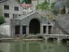
Rock named altar of the Druids. Path to the Witch's Trough. 30 minutes (one way) from the village.
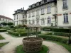

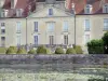
Favourite
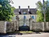


| Municipality | Argillières |
|---|---|
| Postcode | 70600 |
| Tourism label | ") |
| Latitude | 47.6663160 (N 47° 39’ 59”) |
| Longitude | 5.6380229 (E 5° 38’ 17”) |
| Altitude | From 230m to 366m |
| Surface area | 9.58 km² |
| Population | 72 inhabitants |
| Density | 7 inhabitants/km² |
| Prefecture | Vesoul (51 km, 52 min) |
| Insee code | 70027 |
| Intercommunality | CC des Quatre Rivières |
| Department | Haute-Saône |
| Territory | Franche-Comté |
| Region | Burgundy-Franche-Comté |
| Gilley | 3.9 km (8 min) |
|---|---|
| Valleroy | 4.5 km (6 min) |
| Pierrecourt | 4.6 km (8 min) |
| Larret | 4.8 km (8 min) |
| Farincourt | 5.4 km (8 min) |
| Fouvent-Saint-Andoche | 6 km (13 min) |
| Courtesoult-et-Gatey | 6.1 km (10 min) |
| Tornay | 6.7 km (13 min) |
| Savigny | 7.1 km (10 min) |
| Voncourt | 7.3 km (11 min) |
| Bourguignon-lès-Morey | 8.1 km (13 min) |
| Genevrières | 8.5 km (14 min) |
| Roche-et-Raucourt | 9.2 km (16 min) |
| Charmes-Saint-Valbert | 9.7 km (15 min) |
| Champlitte-la-Ville | 10.6 km (16 min) |
Rock named altar of the Druids. Path to the Witch's Trough. 30 minutes (one way) from the village.
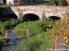
| Natural sites |
|---|


| Last name | Outing type | Difficulty | Duration | Departure municipality |
|---|---|---|---|---|
 | Cycling itinerary | Easy | 1:40 | Grandchamp (15.4 km) |
 | Hike | Intermediate | 7:30 | Chalindrey (21 km) |
 | Cycling itinerary | Intermediate | 2:55 | Chalindrey (22 km) |
 | Hike | Easy | 3:45 | Dommarien (22 km) |
 | Cycling itinerary | Easy | 1:45 | Dommarien (22 km) |