


Favourite
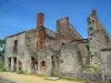
Oradour-sur-Glane
| Municipality | Peyrilhac |
|---|---|
| Postcode | 87510 |
| Latitude | 45.9500990 (N 45° 57’ 0”) |
| Longitude | 1.1348930 (E 1° 8’ 6”) |
| Altitude | From 257m to 383m |
| Surface area | 38.63 km² |
| Population | 1325 inhabitants |
| Density | 34 inhabitants/km² |
| Prefecture | Limoges (26 km, 27 min) |
| Insee code | 87118 |
| Intercommunality | CU Limoges Métropole |
| Department | Haute-Vienne |
| Territory | Limousin |
| Region | New-Aquitaine |
| Saint-Gence | 3.6 km (7 min) |
|---|---|
| Nieul | 4.6 km (8 min) |
| Saint-Jouvent | 6.1 km (7 min) |
| Veyrac | 8.6 km (12 min) |
| Cieux | 8.8 km (10 min) |
| Chamboret | 9.4 km (10 min) |
| Oradour-sur-Glane | 10.2 km (15 min) |
| Nantiat | 10.9 km (15 min) |
| Thouron | 11.9 km (16 min) |
| Vaulry | 12.9 km (16 min) |
| Bonnac-la-Côte | 14.3 km (17 min) |
| Couzeix | 14.4 km (14 min) |
| Compreignac | 14.4 km (17 min) |
| Chaptelat | 15.1 km (16 min) |
| Last name | Outing type | Difficulty | Duration | Departure municipality |
|---|---|---|---|---|
 | Hike | Intermediate | 4:15 | Montrol-Sénard (16.3 km) |
 | Hike | Easy | 6:00 | Razès (18 km) |
 | Hike | Easy | 4:00 | Saint-Léger-la-Montagne (24 km) |
 | Hike | Easy | 4:00 | Gorre (26 km) |
 | Hike | Intermediate | 1:15 | Nexon (31 km) |