

Favourite
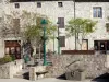
The ruins of Rochebloine Castle
| Municipality | Lafarre |
|---|---|
| Postcode | 07520 |
| Latitude | 45.0789410 (N 45° 4’ 44”) |
| Longitude | 4.5096270 (E 4° 30’ 35”) |
| Altitude | From 540m to 1183m |
| Surface area | 11.33 km² |
| Population | 41 inhabitants |
| Density | 3 inhabitants/km² |
| Prefecture | Privas (79 km, 1:23) |
| Insee code | 07124 |
| Intercommunality | CC du Pays de Lamastre |
| Department | Ardèche |
| Territory | Drôme-Ardèche |
| Region | Auvergne-Rhône-Alps |
| Lalouvesc | 9.4 km (18 min) |
|---|---|
| Saint-Jeure-d'Andaure | 10.4 km (24 min) |
| Labatie-d'Andaure | 11.8 km (23 min) |
| Nozières | 14.4 km (23 min) |
| Pailharès | 14.8 km (23 min) |
| Vaudevant | 15.1 km (26 min) |
| Rochepaule | 15.5 km (28 min) |
| Désaignes | 16.7 km (31 min) |
| Saint-Félicien | 17 km (25 min) |
| Satillieu | 17.3 km (29 min) |
| Saint-Agrève | 18.5 km (37 min) |
| Devesset | 19.4 km (37 min) |
| Saint-Pierre-sur-Doux | 21 km (30 min) |
| Saint-Bonnet-le-Froid | 22 km (33 min) |
| Last name | Activity type | Rate | City |
|---|---|---|---|
 | Entertainment | 30 € | Tence (17.7 km) |
 | Local flavours | Free | Eclassan (22 km) |
| Last name | Outing type | Difficulty | Duration | Departure municipality |
|---|---|---|---|---|
 | Hike | Easy | 1:30 | Désaignes (9.3 km) |
 | Village visit | Intermediate | 4:00 | Désaignes (9.4 km) |
| Hike | Athletic | 7:00 | Désaignes (9.4 km) |
 | Hike | Easy | 1:30 | Devesset (9.6 km) |
| Hike | Athletic | 10:00 | Saint-Agrève (11.8 km) |