Liven up your holidays!

Keskastel

Tourism, holidays & weekends guide in the Bas-Rhin

Keskastel - Tourism, holidays & weekends guide in the Bas-Rhin
8.3
4

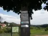
During its history, the village was named in documents by multiple different spellings: Caesaris Castellum, Caister, Castle, Kesekastel, castle, Kaisercastel, keescassel, keisercassel, Kaeskastel.

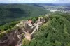
Many historians have issued different versions to explain the origin of the name. Some saw the move or stay the legions of Caesar. The Romans would have raised a fortified camp near the Saarland. It is on this ancient castle mound that the village takes its name "Castellum Caesaris" that is to say, the "Castle of Caesar." The current locality "Schlosshügel" again confirms the existence of a high observing site near a ford to cross the Saar. It is from this data that was created in 1953 the image of Keskastel.

According to another version, Keskastel simply takes its origin of the name carried by the first owner, a nobleman "Kesse" or "Chaso" Germanic knight came from the Kirbel region (near Hombourg-Sarre) and Zweibrucken.

For other historians, the name of the village evoke priority remains the ease of dedicated (Kastenvogt) of Herbitzheim convent.

The former tithe barn in the village was now rue du Faubourg, across the street from the station commonly called "Keesweg". In the term "Kees-veg" we find the same root as that present in "Kees-Kastel". For German Toponymists "Keesweg" mean "Path to the oak forest" and "Kaschel" recall the place where the house of the confessed overlooking the oak forest stood.

Nickname: The villagers are nicknamed "Rieweschwäntz" turnip tails, probably because of the important crop of turnips for animal consumption, but also human form of "turnip sauerkraut." This vegetable is hardly grown today, but every year in October held the traditional festival turnips where you can taste the famous salted turnips "SUERE Riewe".

A legend among others: there are very long lived Keskastel a man in the dark mine, afraid of everyone. After his death, he appeared at the corner window of his house and made fun of passers; it was called the "Graumännel" (gray Hommelet). The then mura the corner window, but the "Graumännel" continued making his. The village priest then casts his mind in a sealed bottle, which sank to the bottom of a pond in the forest, so called since that day, the "graumännelsee".

Geographical information

MunicipalityKeskastel
Postcode67260
Latitude48.9695740 (N 48° 58’ 10”)
Longitude7.0437730 (E 7° 2’ 38”)
AltitudeFrom 209m to 275m
Surface area18.87 km²
Population1530 inhabitants
Density81 inhabitants/km²
PrefectureStrasbourg (85 km, 55 min)
Insee code67234
IntercommunalityCC de l'Alsace Bossue
DepartmentBas-Rhin
TerritoryAlsace
RegionGreat East

Nearest cities & towns

Schopperten3 km (5 min)
Sarralbe4.4 km (6 min)
Sarre-Union5.1 km (6 min)
Herbitzheim6.5 km (8 min)
Hinsingen7.2 km (11 min)
Sarrewerden7.4 km (9 min)
Willerwald7.5 km (9 min)
Le Val-de-Guéblange7.9 km (10 min)
Kirviller8 km (12 min)
Rimsdorf8.3 km (12 min)
Harskirchen8.4 km (10 min)
Bissert9.9 km (13 min)
Voellerdingen9.9 km (12 min)
Oermingen10.1 km (12 min)

Photos

Leisure Centre The Trees
See photo
Keskastel - Aerial View
See photo
Beautiful forest walks to Keskastel
See photo
Keskastel village stork
See photo
Chalets du Centre de Loisirs The Trees
See photo

Weather

Thursday 9 may
Min. 7°C - Max. 20°C
Day
Night
Friday 10 may
Min. 9°C - Max. 21°C
Day
Night
Saturday 11 may
Min. 10°C - Max. 23°C
Day
Night

Visits, leisure and activities nearby

Leisure activities

Last nameActivity typeRateCity
Bike hire
Sports sensations25 € to 80 € Niederbronn-les-Bains (44 km)

Outings

Last nameOuting typeDifficultyDurationDeparture municipality
Along the Eichel
Cycling itineraryEasy4:00Lorentzen (9.9 km)
Heritage of Alsace Bossue
HikeEasy2:00Diemeringen (11 km)
Cycle path following the route of an old railway line
Cycling itineraryEasy4:30Frauenberg (19.6 km)
12-source circuit - Zittersheim
HikeAthletic4:20Zittersheim (23 km)
Three Rocks Trail
HikeIntermediate3:40La Petite-Pierre (24 km)

Restaurants

Bed & breakfasts

Vacation rentals

Campsites

Hotels

Your holidays
A hotel
A vacation rental
A bed & breakfast
A campsite
A leisure activity
A restaurant
A rental car
A plane ticket
By continuing to browse our site, you are agreeing to the use of cookies to improve your experience and make targeted offers.
Find out more and make settings
Your account