Liven up your holidays!
Destination
State your preferences
Guide
Plan your stay
Your account
English
Français
Deutsch
Italiano
Español
Nederlands
Português
Русский
简体中文
日本語
0
0
0
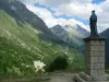
Chantepérier
Menu
Tourism
Gastronomy
Outings
Activities
Events
Restaurants
Hotels
Vacation rentals
Bed & breakfasts
Campsites
Holiday insurance
Rental car
Train tickets
Plane tickets
Transfers
Holiday insurance
Holiday insurance
French courses
Romantic weekend
Family weekend
Cheap weekend
Unusual weekend
Find my position
Confirm
Discover
Tourist sites
Gastronomy
Cities & towns
Tourism labels
Themed itineraries
Custom itineraries
Photos
Panoramas
Tourism quiz
Going out
Leisure activities
Outings
Events
Restaurants
Stay
Hotels
Bed & breakfasts
Vacation rentals
Campsites
Travel
Rental car
Train tickets
Plane tickets
Holiday insurance
Information sheets
French courses
Outings
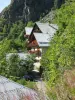
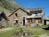
Around Chantepérier
Outings in Chantepérier
Ideas for walks and hikes in Chantepérier
Search
Cancel
39
outings found
Chantepérier
Change
Adjust destination
Town centre of Chantepérier
Locality - Former locality Chantelouve
Locality - Former locality Le Périer
Locality - Former locality Mont-de-Lans (Les Deux Alpes)
Locality - Former locality Vénosc (Les Deux Alpes)
Information point - Tourist Office of Allemond (Allemond)
Information point - Tourist Office of Auris (Auris)
Information point - Tourist Office of L'Alpe d'Huez (L'Alpe d'Huez)
Information point - Tourist Office of La Mure (La Mure)
Information point - Tourist Office of Le Bourg-d'Oisans (Le Bourg-d'Oisans)
Information point - Tourist Office of Les Deux Alpes (Les Deux Alpes)
Information point - Tourist Office of Saint-Christophe-en-Oisans (Saint-Christophe-en-Oisans)
Information point - Tourist Office of Villard-Reculas (Villard-Reculas)
Information point - Tourist Office of Vénosc (Les Deux Alpes)
Information point - Visitor Information Centre of Le Freney-d'Oisans (Le Freney-d'Oisans)
Information point - Visitor Information Centre of Mont-de-Lans (Les Deux Alpes)
Leisure centre - Ski Resort of the Col d'Ornon
Leisure centre - Cultural Space Médiathèque La Matacena (La Mure)
Leisure centre - Municipal Pool of Gavet (Livet-et-Gavet)
Leisure centre - Museum Matheysin de La Mure (La Mure)
Leisure centre - Museum of Huez et de l'Oisans (L'Alpe d'Huez)
Leisure centre - Ski Resort Chamrousse (Chamrousse)
Leisure centre - Ski Resort Les 2 Alpes (Les Deux Alpes)
Leisure centre - Ski Resort of Auris en Oisans (Auris)
Leisure centre - Ski Resort of Villard-Reculas (Villard-Reculas)
Leisure centre - Ski Resort of the Alpe d'Huez (Huez)
Leisure centre - Ski Resort of the Alpe du Grand Serre (La Morte)
Performance hall - Cinema-Theatre La Mure (La Mure)
Natural site - Plateau of the Arselle (Chamrousse)
Natural site - Rocks of Rioupéroux (Livet-et-Gavet)
Sort by distance from starting point
Sort by difficulty
Sort by change in altitude
Sort by duration
Sort by length in kilometres
Filter results
Open map
Outing type
Hike
Cycling itinerary
Horse ride
Other means of transport
Distance from starting point
Less than 10 km
from 10 km to 30 km
More than 30 km
Difficulty
Easy
Intermediate
Athletic
Change in altitude
Less than 200 m
from 200 m to 500 m
from 500 m to 1000 m
More than 1000 m
Duration
Less than 2 h
from 2 h to 4 h
More than 4 h
Kilometres
Less than 5 km
from 5 km to 10 km
from 10 km to 20 km
More than 20 km
Territory
Alps
Dauphiné
Drôme-Ardèche
Filter results
Hide filters
Open map
Hide map
Outings in Chantepérier
Outings around Chantepérier
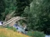
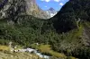
Pursollet Lake from Gavet
4.5
2
Hike in Livet-et-Gavet
Athletic
4:00, 10 km (change in altitude 1200m)
Walking route to discover the sumptuous Pursollet Lake from the village of Gavet.
Located
12 km
away of Chantepérier
Favourite
Itinerary
Rioupéroux-Chamrousse, vertical route of the Ut4M race
9.0
2
Hike in Livet-et-Gavet
Athletic
3:00, 8 km (change in altitude 1121m)
Every year, the Ut4M race attracts hundreds of runners, test yourself the vertical kilometer of the race. Quality itinerary, open to all, the view is breathtaking on the Romanche valley, the landscape is Mediterranean and sunny. The arrival…
Located
13 km
away of Chantepérier
Favourite
Itinerary
9.8
4
Hike in Saint-Christophe-en-Oisans
Easy
55 min, 2 km (change in altitude 135m)
Located
15.5 km
away of Chantepérier
Favourite
Itinerary
9.1
4
Hike in Saint-Christophe-en-Oisans
Athletic
1:45, 1 km (change in altitude 569m)
Located
15.6 km
away of Chantepérier
Favourite
Itinerary
9.1
3
Hike in Saint-Christophe-en-Oisans
Intermediate
2:10, 5 km (change in altitude 348m)
Located
16.2 km
away of Chantepérier
Favourite
Itinerary
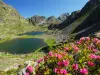
Robert Lakes
6.7
27
Hike in Chamrousse
Intermediate
1:30, 3 km (change in altitude 348m)
Set off to explore the mountain lakes around Chamrousse...
Located
16.4 km
away of Chantepérier
Favourite
Itinerary
Vizille panoramic viewpoint
7.0
10
Hike in Vizille
Intermediate
2:00, 6 km (change in altitude 260m)
Departing from the centre of Vizille, outside the castle, the climb winds up through the forest for about 30 minutes. At the panoramic viewpoint, the hard work is well rewarded: this site offers a view over the Vercors Massif, the Connex Mountain,…
Located
18.5 km
away of Chantepérier
Favourite
Itinerary
9.3
6
Hike in Saint-Christophe-en-Oisans
Intermediate
3:15, 9 km (change in altitude 400m)
Located
18.9 km
away of Chantepérier
Favourite
Itinerary
9.4
5
Hike in Saint-Christophe-en-Oisans
Athletic
6:40, 11 km (change in altitude 1557m)
Located
19 km
away of Chantepérier
Favourite
Itinerary
6.8
2
Hike in Saint-Christophe-en-Oisans
Athletic
4:35, 6 km (change in altitude 1214m)
Located
21 km
away of Chantepérier
Favourite
Itinerary
9.2
5
Hike in Saint-Christophe-en-Oisans
Intermediate
2:30, 3 km (change in altitude 688m)
Located
21 km
away of Chantepérier
Favourite
Itinerary
8.6
5
Hike in Saint-Christophe-en-Oisans
Athletic
5:00, 8 km (change in altitude 1173m)
Located
22 km
away of Chantepérier
Favourite
Itinerary
8.0
2
Hike in Saint-Christophe-en-Oisans
Intermediate
3:20, 10 km (change in altitude 320m)
Located
24 km
away of Chantepérier
Favourite
Itinerary
The Châtel Bonnet Calvin
8.2
5
Hike in Mens
Intermediate
5:00, 12 km (change in altitude 700m)
Family hike between forest and pasture. The top of Châtel, pre suspended between earth and sky, is an extraordinary viewpoint on the lakes of Laffrey, Trièves, Matheysine and Dévoluy.
Located
25 km
away of Chantepérier
Favourite
Itinerary
Pas de la Balme
9.0
4
Hike in Château-Bernard
Athletic
4:40, 10 km (change in altitude 364m)
Walk along the eastern balcony of the Vercors, to the Pas de la Balme, one of the gateways to the High Plateaux of the Vercors. On the way, you will be able to observe ibex. It is possible to extend the walk to the legendary Saracens Wall.
Located
31 km
away of Chantepérier
Favourite
Itinerary
Tour of Mont Aiguille
8.3
3
Hike in Monestier-du-Percy
Athletic
7:30, 22 km (change in altitude 1100m)
Unmissable hike in the Trièves which offers some spectacular views of the sacred mountain (Mont Aiguille) especially from the Aupet and Papavet passes. Discovery of tiny hamlets like Trésanne. The tour of Mont Aiguille can start on the south…
Located
32 km
away of Chantepérier
Favourite
Itinerary
Molière Plateau
7.2
18
Hike in Lans-en-Vercors
Intermediate
4:00, 12 km (change in altitude 300m)
The path, which is in very good condition, climbs to a first flat section (about 1.5 km) then, after a short steep climb, you arrive at the vast Molière plateau overlooking the valley of Grenoble above the village of Engins. The path is then…
Located
35 km
away of Chantepérier
Favourite
Itinerary
Heritage Visit
9.4
5
Village visit in Corrençon-en-Vercors
Easy
1:00, 3 km (change in altitude 50m)
Set out to discover the heritage and history of Corrençon thanks to the thematic boards. Heritage walk to be enjoyed with all the family.
Located
36 km
away of Chantepérier
Favourite
Itinerary
9.3
1
Hike in Champoléon
Easy
6:40, 10 km (change in altitude 1606m)
Located
37 km
away of Chantepérier
Favourite
Itinerary
Lakes of Seven Laux
9.0
3
Hike in Le Haut-Bréda
Athletic
6:00, 16 km (change in altitude 1100m)
This mountain hike will allow you to discover beautiful landscapes dotted with ten lakes of all sizes, in the middle of pastures and scree.
Located
38 km
away of Chantepérier
Favourite
Itinerary
The white bridge trail
7.5
10
Hike in Saint-Laurent-du-Cros
Easy
3:00, 8 km (change in altitude 201m)
In the heart of the Champsaur valley, a discovery trail accessible to all users: walkers, horse riders, cyclists. Signposted with interpretation boards. Discover the antique "Roman Way", the abandoned railway line project between Corps and Gap,…
Located
40 km
away of Chantepérier
Favourite
Itinerary
8.5
3
Cycling itinerary in Saint-Jean-Saint-Nicolas
Athletic
4:10, 48 km (change in altitude 2452m)
Located
41 km
away of Chantepérier
Favourite
Itinerary
Poingt Ravier Eco-Forest Trail
7.2
13
Hike in Valloire
Easy
2:30, 10 km (change in altitude 256m)
Botanical trail with information boards about the mountain trees and, in particular, the spruce. Route which also offers the chance to visit the typical hamlet of Poingt Ravier with its traditional houses, and to take advantage of the view towards…
Located
41 km
away of Chantepérier
Favourite
Itinerary
Valloirette Fitness Trail
7.8
4
Hike in Valloire
Easy
2:00, 2 km (change in altitude 100m)
Forest trail with a walking path and exercise stations, warm-up space, two suppleness and strength spaces, a coordination and balance space, a balance and relaxation space.
Located
41 km
away of Chantepérier
Favourite
Itinerary
Revoulat Panoramic Viewpoint
7.7
19
Hike in La Chapelle-en-Vercors
Easy
2:00, 8 km (change in altitude 0m)
Short family walk to a magnificent viewpoint over the Grands Goulets and the Vercors. The walk can be prolonged for good walkers.
Located
44 km
away of Chantepérier
Favourite
Itinerary
See more results
By continuing to browse our site, you are agreeing to the use of cookies to improve your experience and make targeted offers.
Find out more and make settings
Close
Your account
Continue with my email