
Favourite
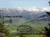
Allos pass
| Municipality | Prads-Haute-Bléone |
|---|---|
| Postcode | 04420 |
| Latitude | 44.2198120 (N 44° 13’ 11”) |
| Longitude | 6.4428070 (E 6° 26’ 34”) |
| Altitude | From 831m to 2920m |
| Surface area | 165.64 km² |
| Population | 178 inhabitants |
| Density | 1 inhabitants/km² |
| Prefecture | Digne-les-Bains (27 km, 28 min) |
| Insee code | 04155 |
| Intercommunality | CA Provence-Alpes-Agglomération |
| Department | Alpes-de-Haute-Provence |
| Territories | Alps, Provence |
| Region | Provence-Alps-French Riviera |
| La Javie | 12.5 km (21 min) |
|---|---|
| Le Brusquet | 15.9 km (24 min) |
| Beaujeu | 16.3 km (24 min) |
| Marcoux | 21 km (29 min) |
| Draix | 27 km (38 min) |
| Verdaches | 27 km (37 min) |
| Archail | 27 km (41 min) |
| Digne-les-Bains | 28 km (37 min) |
| Le Vernet | 29 km (35 min) |
| La Robine-sur-Galabre | 30 km (42 min) |
| Barles | 34 km (43 min) |
| Auzet | 34 km (44 min) |
| Seyne | 39 km (45 min) |
| Selonnet | 44 km (50 min) |
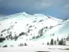
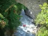
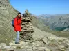
| Natural sites |
|---|
| Last name | Activity type | Rate | City |
|---|---|---|---|
 | Sports sensations | 45 € to 85 € | Le Lauzet-Ubaye (24 km) |
 | Sports sensations | 44 € | Ubaye-Serre-Ponçon (26 km) |
 | Sports sensations | 85 € to 115 € | Ubaye-Serre-Ponçon (27 km) |
 | Nature and the great outdoors | 180 € | Faucon-de-Barcelonnette (27 km) |
 | Sports sensations | 65 € | Jausiers (33 km) |
| Last name | Outing type | Difficulty | Duration | Departure municipality |
|---|---|---|---|---|
 | Hike | Intermediate | 4:30 | La Robine-sur-Galabre (18.7 km) |
 | Hike | Easy | 25 min | Digne-les-Bains (21 km) |
 | Hike | Easy | 1:00 | Digne-les-Bains (22 km) |
 | Hike | Intermediate | 3:30 | Entraunes (24 km) |
 | Hike | Easy | 1:00 | Saint-Martin-d'Entraunes (27 km) |