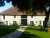

Preferito
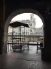
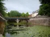
Le fontane-lavatoi


| Comune | Oiselay-et-Grachaux |
|---|---|
| Codice postale | 70700 |
| Latitudine | 47.4205070 (N 47° 25’ 14”) |
| Longitudine | 5.9319540 (E 5° 55’ 55”) |
| Altitudine | Da 254m a 432m |
| Superficie | 22.99 km² |
| Popolazione | 433 abitanti |
| Densità | 18 abitanti/km² |
| Prefettura | Vesoul (32 km, 31 min) |
| Codice Insee | 70393 |
| Inter-comunalità | CC du Pays Riolais |
| Dipartimento | Alta Saona |
| Territorio | Franca Contea |
| Regione | Borgogna-Franca Contea |
| Bonnevent-Velloreille | 2.9 km (4 min) |
|---|---|
| Cordonnet | 3.8 km (9 min) |
| Villers-Bouton | 5.5 km (7 min) |
| Villers-Chemin-et-Mont-lès-Étrelles | 6.7 km (6 min) |
| Velleclaire | 7 km (7 min) |
| Montboillon | 7.2 km (10 min) |
| Fretigney-et-Velloreille | 7.8 km (9 min) |
| Vantoux-et-Longevelle | 8.2 km (9 min) |
| Frasne-le-Château | 8.4 km (9 min) |
| Étuz | 8.4 km (11 min) |
| Chaux-la-Lotière | 8.5 km (12 min) |
| Bucey-lès-Gy | 8.9 km (11 min) |
| Étrelles-et-la-Montbleuse | 9.2 km (12 min) |
| Recologne-lès-Rioz | 9.5 km (14 min) |
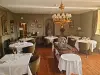
| Cognome | Tipo di attività | Tariffa | Città |
|---|---|---|---|
 | Divertimenti | da 84 € a 110 € | Besançon (21 km) |
| Cognome | Tipo di passeggiata | Difficoltà | Durata | Comune di partenza |
|---|---|---|---|---|
 | Escursione a piedi | Media | 1:20 | Bucey-lès-Gy (6.2 km) |
 | Escursione a piedi | Facile | 2:35 | Bucey-lès-Gy (6.9 km) |
 | Escursione a piedi | Sportiva | 5:05 | Fretigney-et-Velloreille (7.3 km) |
 | Escursione a piedi | Media | 2:30 | Gy (9.1 km) |
 | Escursione a piedi | Facile | 1:50 | Gy (9.1 km) |