


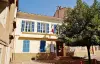
Favourite
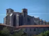
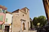
The Basilica of Saint-Maximin-la-Sainte-Baume


| Municipality | Rougiers |
|---|---|
| Postcode | 83170 |
| Latitude | 43.3927550 (N 43° 23’ 34”) |
| Longitude | 5.8517150 (E 5° 51’ 6”) |
| Altitude | From 309m to 741m |
| Surface area | 20.53 km² |
| Population | 1699 inhabitants |
| Density | 82 inhabitants/km² |
| Prefecture | Toulon (54 km, 50 min) |
| Insee code | 83110 |
| Intercommunality | CA de la Provence Verte |
| Department | Var |
| Territories | French Riviera, Provence |
| Region | Provence-Alps-French Riviera |
| Tourves | 7.1 km (10 min) |
|---|---|
| Saint-Maximin-la-Sainte-Baume | 7.8 km (12 min) |
| Nans-les-Pins | 7.9 km (11 min) |
| Mazaugues | 10.9 km (15 min) |
| Ollières | 12.5 km (17 min) |
| Saint-Zacharie | 13.1 km (14 min) |
| Pourcieux | 14.8 km (19 min) |
| Seillons-Source-d'Argens | 15 km (21 min) |
| Bras | 16 km (21 min) |
| Brignoles | 18.3 km (18 min) |
| La Celle | 18.6 km (16 min) |
| La Roquebrussanne | 19.3 km (19 min) |
| Auriol | 19.9 km (22 min) |
| Brue-Auriac | 21 km (21 min) |
| Last name | Activity type | Rate | City |
|---|---|---|---|
 | Entertainment | 22 € | Aubagne (29 km) |
 | Local flavours | Free | Flassans-sur-Issole (31 km) |
 | Entertainment | 17 € | Le Tholonet (31 km) |
 | Sports sensations | 230 € | Sanary-sur-Mer (31 km) |
 | Nature and the great outdoors | 35 € to 65 € | Cassis (32 km) |
| Last name | Outing type | Difficulty | Duration | Departure municipality |
|---|---|---|---|---|
 | Hike | Easy | 4:00 | Tourves (6 km) |
| Hike | Easy | 2:00 | Tourves (6.1 km) |
| Hike | Easy | 4:00 | La Destrousse (20 km) |
 | Hike | Intermediate | 1:30 | Puyloubier (21 km) |
| Mountain bike itinerary | Easy | 1:00 | Gréasque (25 km) |