

Favourite
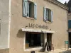
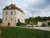
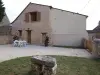
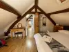
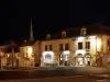
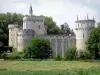
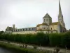
Château-Guillaume
| Municipality | Mauvières |
|---|---|
| Postcode | 36370 |
| Latitude | 46.5743719 (N 46° 34’ 28”) |
| Longitude | 1.0876310 (E 1° 5’ 15”) |
| Altitude | From 84m to 147m |
| Surface area | 23.94 km² |
| Population | 302 inhabitants |
| Density | 12 inhabitants/km² |
| Prefecture | Châteauroux (62 km, 1:03) |
| Insee code | 36114 |
| Intercommunality | CC Marche Occitane - Val d'Anglin |
| Department | Indre |
| Territory | Berry |
| Region | Centre-Loire Valley |
| Saint-Hilaire-sur-Benaize | 4 km (7 min) |
|---|---|
| Concremiers | 6.7 km (13 min) |
| Bélâbre | 7 km (12 min) |
| Le Blanc | 8.6 km (13 min) |
| Liglet | 9.7 km (15 min) |
| Saint-Aigny | 10.5 km (14 min) |
| Ruffec | 10.9 km (18 min) |
| Chalais | 12.6 km (18 min) |
| Béthines | 13.7 km (17 min) |
| Sauzelles | 13.8 km (19 min) |
| Pouligny-Saint-Pierre | 14.6 km (19 min) |
| Ingrandes | 15.6 km (18 min) |
| Ciron | 17 km (23 min) |
| Fontgombault | 17 km (21 min) |
| Last name | Outing type | Difficulty | Duration | Departure municipality |
|---|---|---|---|---|
 | Hike | Easy | 4:05 | Journet (10 km) |
 | Hike | Intermediate | 1:45 | La Trimouille (12.5 km) |
 | Car itinerary | Easy | 1:00 | La Trimouille (12.6 km) |
 | Car itinerary | Easy | 1:00 | La Trimouille (12.6 km) |
 | Hike | Easy | 2:30 | Thollet (15.9 km) |