
Favourite
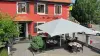
Mulhouse and its famous museums
| Municipality | Heiwiller |
|---|---|
| Postcode | 68130 |
| Latitude | 47.6242710 (N 47° 37’ 27”) |
| Longitude | 7.3230980 (E 7° 19’ 23”) |
| Altitude | From 300m to 372m |
| Surface area | 2.04 km² |
| Population | 165 inhabitants |
| Density | 80 inhabitants/km² |
| Prefecture | Colmar (63 km, 49 min) |
| Insee code | 68131 |
| Intercommunality | CC Sundgau |
| Department | Haut-Rhin |
| Territory | Alsace |
| Region | Great East |
| Tagsdorf | 1.7 km (3 min) |
|---|---|
| Wahlbach | 2.1 km (3 min) |
| Obermorschwiller | 2.4 km (10 min) |
| Schwoben | 2.4 km (4 min) |
| Emlingen | 2.9 km (5 min) |
| Zaessingue | 3.9 km (5 min) |
| Hausgauen | 4.1 km (5 min) |
| Wittersdorf | 4.1 km (6 min) |
| Hundsbach | 5.6 km (7 min) |
| Koetzingue | 6 km (6 min) |
| Franken | 6.7 km (7 min) |
| Magstatt-le-Haut | 6.7 km (10 min) |
| Rantzwiller | 6.8 km (8 min) |
| Walheim | 7.1 km (10 min) |
| Last name | Outing type | Difficulty | Duration | Departure municipality |
|---|---|---|---|---|
 | Hike | Intermediate | 1:00 | Burnhaupt-le-Haut (17.6 km) |
 | Hike | Intermediate | 1:05 | Thann (26 km) |
 | Village visit | Easy | 1:00 | Masevaux-Niederbruck (30 km) |
 | Hike | Intermediate | 3:00 | Masevaux-Niederbruck (30 km) |
 | Hike | Intermediate | 2:30 | Kirchberg (33 km) |