Favourite
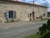
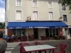
Charroux
| Municipality | Chatain |
|---|---|
| Postcode | 86250 |
| Latitude | 46.0726960 (N 46° 4’ 22”) |
| Longitude | 0.4329320 (E 0° 25’ 59”) |
| Altitude | From 125m to 193m |
| Surface area | 22.05 km² |
| Population | 250 inhabitants |
| Density | 11 inhabitants/km² |
| Prefecture | Poitiers (72 km, 1:09) |
| Insee code | 86063 |
| Intercommunality | CC du Civraisien en Poitou |
| Department | Vienne |
| Territory | Poitou |
| Region | New-Aquitaine |
| Benest | 4.9 km (8 min) |
|---|---|
| Surin | 5.2 km (9 min) |
| Pleuville | 6.7 km (11 min) |
| Asnois | 8 km (12 min) |
| Genouillé | 9.8 km (14 min) |
| Charroux | 9.8 km (15 min) |
| Alloue | 10.1 km (16 min) |
| Le Bouchage | 10.2 km (15 min) |
| Saint-Coutant | 11.2 km (17 min) |
| Champagne-Mouton | 11.4 km (17 min) |
| Épenède | 11.4 km (17 min) |
| Vieux-Ruffec | 12.6 km (17 min) |
| Saint-Gaudent | 13.7 km (20 min) |
| La Chapelle-Bâton | 15 km (22 min) |
| Last name | Activity type | Rate | City |
|---|---|---|---|
 | Entertainment | 52 € to 84 € | La Rochefoucauld-en-Angoumois (37 km) |
| Last name | Outing type | Difficulty | Duration | Departure municipality |
|---|---|---|---|---|
 | Hike | Easy | 3:20 | Saint-Martin-l'Ars (17.6 km) |
 | Car itinerary | Easy | 55 min | Availles-Limouzine (18.1 km) |
 | Hike | Intermediate | 55 min | Availles-Limouzine (18.1 km) |
 | Car itinerary | Easy | 1:05 | L'Isle-Jourdain (26 km) |
 | Hike | Intermediate | 2:00 | L'Isle-Jourdain (26 km) |