

Favourite
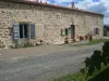
Charroux
| Municipality | Saint-Coutant |
|---|---|
| Postcode | 16350 |
| Latitude | 46.0037280 (N 46° 0’ 13”) |
| Longitude | 0.4498770 (E 0° 26’ 60”) |
| Altitude | From 133m to 197m |
| Surface area | 19.40 km² |
| Population | 217 inhabitants |
| Density | 11 inhabitants/km² |
| Prefecture | Angoulême (66 km, 1:05) |
| Insee code | 16310 |
| Intercommunality | CC de Charente Limousine |
| Department | Charente |
| Territory | Charentes |
| Region | New-Aquitaine |
| Champagne-Mouton | 5.7 km (8 min) |
|---|---|
| Benest | 6.4 km (10 min) |
| Alloue | 7.1 km (8 min) |
| Vieux-Ruffec | 8.8 km (12 min) |
| Saint-Laurent-de-Céris | 9.1 km (15 min) |
| Ambernac | 9.1 km (14 min) |
| Turgon | 9.5 km (15 min) |
| Le Vieux-Cérier | 9.6 km (12 min) |
| Chassiecq | 10.5 km (16 min) |
| Le Bouchage | 10.9 km (18 min) |
| Chatain | 11.2 km (17 min) |
| Épenède | 11.7 km (15 min) |
| Le Grand-Madieu | 12.3 km (14 min) |
| Nanteuil-en-Vallée | 12.5 km (16 min) |
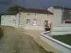
| Monuments |
|---|
| Last name | Activity type | Rate | City |
|---|---|---|---|
 | Entertainment | 52 € to 84 € | La Rochefoucauld-en-Angoumois (30 km) |
| Last name | Outing type | Difficulty | Duration | Departure municipality |
|---|---|---|---|---|
 | Car itinerary | Easy | 55 min | Availles-Limouzine (21 km) |
 | Hike | Intermediate | 55 min | Availles-Limouzine (21 km) |
 | Hike | Easy | 3:20 | Saint-Martin-l'Ars (24 km) |
 | Car itinerary | Easy | 1:05 | L'Isle-Jourdain (31 km) |
 | Hike | Intermediate | 2:00 | L'Isle-Jourdain (31 km) |