
Favourite
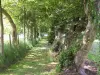
The Circuit of Remembrance
| Municipality | Beaumont-Hamel |
|---|---|
| Postcode | 80300 |
| Latitude | 50.0839140 (N 50° 5’ 2”) |
| Longitude | 2.6563840 (E 2° 39’ 23”) |
| Altitude | From 70m to 148m |
| Surface area | 8.31 km² |
| Population | 204 inhabitants |
| Density | 24 inhabitants/km² |
| Prefecture | Amiens (38 km, 43 min) |
| Insee code | 80069 |
| Intercommunality | CC du Pays du Coquelicot |
| Department | Somme |
| Territory | Picardy |
| Region | Hauts-de-France |
| Auchonvillers | 2.1 km (4 min) |
|---|---|
| Beaucourt-sur-l'Ancre | 2.4 km (4 min) |
| Mailly-Maillet | 4.3 km (7 min) |
| Grandcourt | 4.8 km (7 min) |
| Thiepval | 5.2 km (8 min) |
| Mesnil-Martinsart | 5.2 km (8 min) |
| Englebelmer | 5.3 km (11 min) |
| Colincamps | 5.7 km (12 min) |
| Miraumont | 6.4 km (9 min) |
| Hébuterne | 6.7 km (11 min) |
| Authuille | 7.2 km (10 min) |
| Irles | 8.4 km (12 min) |
| Pozières | 8.4 km (12 min) |
| Aveluy | 8.5 km (10 min) |
| Monuments | |
|---|---|
| Natural sites |
| Last name | Activity type | Rate | City |
|---|---|---|---|
 | Culture and education | 35 € to 55 € | Auxi-le-Château (41 km) |
| Last name | Outing type | Difficulty | Duration | Departure municipality |
|---|---|---|---|---|
 | Hike | Easy | 3:05 | Beaumont-Hamel |
 | Hike | Easy | 3:00 | Dernancourt (12.4 km) |
 | Hike | Intermediate | 2:40 | Pas-en-Artois (14.2 km) |
 | Hike | Easy | 2:35 | Thièvres (15.1 km) |
 | Hike | Easy | 4:55 | Grand-Rullecourt (23 km) |