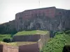
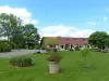
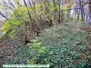
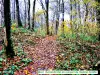
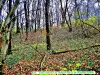
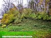
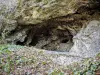
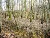
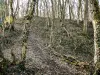
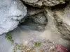
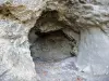
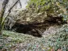
Visit the entrenched camp, Neolithic and Gallic, at a place called Chataillon.
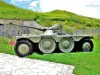
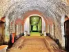
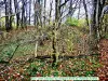
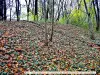
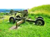
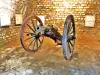
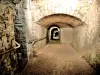
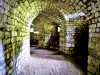
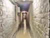
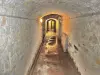
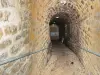
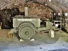
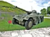
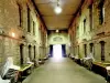
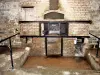
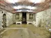
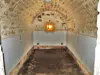
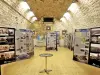
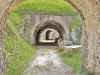
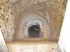
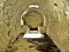
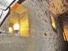
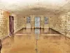
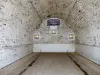
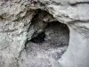
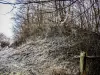
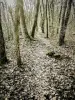
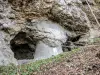
Visit the fort of Mount Bart.


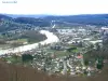
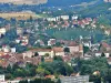
| Municipality | Bart |
|---|---|
| Postcode | 25420 |
| Latitude | 47.4918570 (N 47° 29’ 31”) |
| Longitude | 6.7720180 (E 6° 46’ 19”) |
| Altitude | From 309m to 480m |
| Surface area | 3.84 km² |
| Population | 2059 inhabitants |
| Density | 536 inhabitants/km² |
| Prefecture | Besançon (78 km, 55 min) |
| Insee code | 25043 |
| Intercommunality | CA Pays de Montbéliard Agglomération |
| Department | Doubs |
| Territories | Franche-Comté, Jura mountains |
| Region | Burgundy-Franche-Comté |
| Courcelles-lès-Montbéliard | 1.5 km (3 min) |
|---|---|
| Sainte-Suzanne | 1.9 km (4 min) |
| Voujeaucourt | 2.3 km (4 min) |
| Dung | 2.6 km (5 min) |
| Présentevillers | 4 km (6 min) |
| Allondans | 4.6 km (8 min) |
| Bavans | 4.6 km (7 min) |
| Berche | 4.7 km (8 min) |
| Dampierre-sur-le-Doubs | 4.9 km (8 min) |
| Montbéliard | 4.9 km (9 min) |
| Arbouans | 6 km (10 min) |
| Issans | 6.6 km (10 min) |
| Exincourt | 6.8 km (12 min) |
| Sainte-Marie | 6.8 km (8 min) |
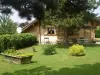
Visit the entrenched camp, Neolithic and Gallic, at a place called Chataillon.
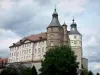
Visit the fort of Mount Bart.

| Last name | Activity type | Rate | City |
|---|---|---|---|
 | Culture and education | 11 € | Le Thillot (43 km) |
| Last name | Outing type | Difficulty | Duration | Departure municipality |
|---|---|---|---|---|
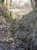
 | Hike | Intermediate | 35 min | Grand-Charmont (4.9 km) |
 | Hike | Easy | 1:00 | Pays-de-Clerval (23 km) |
 | Village visit | Easy | 1:00 | Masevaux-Niederbruck (36 km) |
 | Hike | Intermediate | 3:00 | Masevaux-Niederbruck (36 km) |
 | Hike | Easy | 1:00 | Sewen (36 km) |