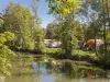


- Geographic location:
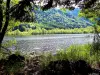
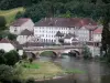
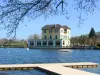
- Located 8 km from the capital district of Montbéliard, crossed by the RD 663, nestled at the confluence of the Doubs and Allan, the town of Bavans is bordered to the south by the river, northeast by Mount Bart and northwest by Mount St. Mary.
- It is a well-defined territory, extending to the enamelling Dodu of nearly 3 km. Covering an area of 883 ha, including 365 forest, the village, built at an altitude of 315 m, is now spreading on the top shelf.
- History:
- The name dates back to Bavans Burgundian occupation (sixth or seventh century). Formed by the suffix Years (owned by ...) and the prefix Bav (contraction of the name of the first owner of the place). Property Bavans = Bav ... Bavans name appears for the first time in a document written in 1140 but it is likely that its origin goes back to a time more distant. The second assumption of the name, issued in 1937 is that Bavans takes its name from two Celtic words: Ba (abundant) and Van (fountain). It would mean "abundant springs".
- Note that a plaque buckle belt Bavans 1500 years old, was discovered in 1928 in the floor of the house at 18 rue des Fleurs. It is visible at the Museum of the castle of Montbéliard. It is believed to date from the late 7th century. The square thumbnails of this belt suggest a story. It would be in the presence of the oldest comic Bavans!
- The number of inhabitants increased from 124 in 1615 to about 4000 in 2008.