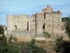
This path winds around the Rieusset valley and passes through Rochessadoule, which is part of the municipality of Robiac-Rochessadoule. It is possible to obtain a leaflet presenting the route from Bessèges Tourist Office.

The Cocalière cave
This path winds around the Rieusset valley and passes through Rochessadoule, which is part of the municipality of Robiac-Rochessadoule. It is possible to obtain a leaflet presenting the route from Bessèges Tourist Office.

| Department | Gard |
|---|---|
| Departure municipality | Robiac-Rochessadoule |
| Outing type | Hike |
| Difficulty | Intermediate |
| Duration | 3:00 |
| Recommended period | from january to december |
| Environment | Countryside |
| Kilometres | 8 km |
| Altitude upon departure | 150m |
| Change in altitude | 250m |
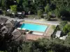
Starting point and arrival point outside the municipal campsite in the Valette neighbourhood (1 km east of Rochessadoule along the D162).
This path is signposted in yellow.
Depart from the municipal campsite in Valette.
Follow the old mine railway line.
At the bridge, cross the railway line.
Climb up towards Vieux Buis.
In this neighbourhood, follow the yellow signposting that leads you to Rochessadoule.
Descend to Rochessadoule.
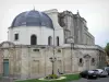
Take the old railway line opposite the church and then continue to the campsite in Valette.