Liven up your holidays!
Destination
State your preferences
Guide
Plan your stay
Your account
English
Français
Deutsch
Italiano
Español
Nederlands
Português
Русский
简体中文
日本語
0
0
0
Sainte-Foy-Tarentaise
Menu
Tourism
Gastronomy
Outings
Activities
Events
Restaurants
Hotels
Vacation rentals
Bed & breakfasts
Campsites
Holiday insurance
Rental car
Train tickets
Plane tickets
Transfers
Holiday insurance
Holiday insurance
French courses
Romantic weekend
Family weekend
Cheap weekend
Unusual weekend
Find my position
Confirm
Discover
Tourist sites
Gastronomy
Cities & towns
Tourism labels
Themed itineraries
Custom itineraries
Photos
Panoramas
Tourism quiz
Going out
Leisure activities
Outings
Events
Restaurants
Stay
Hotels
Bed & breakfasts
Vacation rentals
Campsites
Travel
Rental car
Train tickets
Plane tickets
Holiday insurance
Information sheets
French courses
Outings
Around Sainte-Foy-Tarentaise
Outings in Sainte-Foy-Tarentaise
Ideas for walks and hikes in Sainte-Foy-Tarentaise
Search
Cancel
45
outings found
Sainte-Foy-Tarentaise
Change
Adjust destination
Town centre of Sainte-Foy-Tarentaise
Locality - Former locality Bellentre (La Plagne Tarentaise)
Locality - Former locality La Côte-d'Aime (La Plagne Tarentaise)
Locality - Former locality Mâcot-la-Plagne (La Plagne Tarentaise)
Locality - Former locality Valezan (La Plagne Tarentaise)
Transport - Train station of Bourg-Saint-Maurice (Bourg-Saint-Maurice)
Transport - Train station of Landry (Landry)
Information point - Tourist Office of Sainte-Foy-Tarentaise
Information point - Tourist Office of Landry (Landry)
Information point - Tourist Office of Les Arcs (Les Arcs)
Information point - Tourist Office of Montvalezan (Montvalezan)
Information point - Tourist Office of Mâcot-la-Plagne (La Plagne Tarentaise)
Information point - Tourist Office of Peisey-Nancroix (Peisey-Nancroix)
Information point - Tourist Office of Val-d'Isère (Val-d'Isère)
Leisure centre - Ski Resort of Sainte-Foy-Tarentaise
Leisure centre - Museum of the Costume (Bourg-Saint-Maurice)
Leisure centre - Ski Resort La Rosière (Montvalezan)
Leisure centre - Ski Resort Montchavin-La Plagne (La Plagne Tarentaise)
Leisure centre - Ski Resort Peisey-Vallandry (Peisey-Nancroix)
Leisure centre - Ski Resort of Tignes (Tignes)
Leisure centre - Ski Resort of Val d'Isère (Val-d'Isère)
Leisure centre - Ski Resort of the Arcs - Bourg-Saint-Maurice (Bourg-Saint-Maurice)
Monument - Chapel Sainte-Brigide et Saint-Ours
Monument - Chapel Saint-Grat (Bourg-Saint-Maurice)
Monument - Church Saint-Michel (Landry)
Monument - Church of Peisey-Nancroix (Peisey-Nancroix)
Monument - Church of Val-d'Isère (Val-d'Isère)
Monument - Dolmen of Mâcot-la-Plagne (La Plagne Tarentaise)
Monument - Farm of Villarivon (Les Chapelles)
Monument - Sanctuary of Notre-Dame des Vernettes (Peisey-Nancroix)
Sort by distance from starting point
Sort by difficulty
Sort by change in altitude
Sort by duration
Sort by length in kilometres
Filter results
Open map
Outing type
Hike
Cycling itinerary
Horse ride
Other means of transport
Distance from starting point
Less than 10 km
from 10 km to 30 km
More than 30 km
Difficulty
Easy
Intermediate
Athletic
Change in altitude
Less than 200 m
from 200 m to 500 m
from 500 m to 1000 m
More than 1000 m
Duration
Less than 2 h
from 2 h to 4 h
More than 4 h
Kilometres
Less than 5 km
from 5 km to 10 km
from 10 km to 20 km
More than 20 km
Filter results
Hide filters
Open map
Hide map
Outings in Sainte-Foy-Tarentaise
Outings around Sainte-Foy-Tarentaise
The Butter Clod
8.0
1
Hike in La Léchère
Easy
1:00, 3 km (change in altitude 137m)
Walk to discover and appreciate the panoramas visible from the upper Nâves valley.
Located
25 km
away of Sainte-Foy-Tarentaise
Favourite
Itinerary
Dzonfié loop
8.0
1
Village visit in La Léchère
Athletic
4:00, 8 km (change in altitude 515m)
A route to climb the highest point of the Nâves valley: the Dzonfié (2455 m).
Located
25 km
away of Sainte-Foy-Tarentaise
Favourite
Itinerary
9.2
4
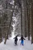
Snowshoe hike in Courchevel
Athletic
2:35, 5 km (change in altitude 263m)
Located
26 km
away of Sainte-Foy-Tarentaise
Favourite
Itinerary
9.6
3
Snowshoe hike in Courchevel
Athletic
3:45, 6 km (change in altitude 509m)
Located
26 km
away of Sainte-Foy-Tarentaise
Favourite
Itinerary
9.3
4
Hike in Courchevel
Easy
20 min, 1 km (change in altitude 7m)
Located
27 km
away of Sainte-Foy-Tarentaise
Favourite
Itinerary
9.3
3
Snowshoe hike in Courchevel
Intermediate
1:30, 3 km (change in altitude 139m)
Located
28 km
away of Sainte-Foy-Tarentaise
Favourite
Itinerary
7.8
3
Hike in Courchevel
Easy
3:00, 8 km (change in altitude 394m)
Located
28 km
away of Sainte-Foy-Tarentaise
Favourite
Itinerary
9.4
5
Snowshoe hike in Courchevel
Athletic
1:50, 2 km (change in altitude 344m)
Located
28 km
away of Sainte-Foy-Tarentaise
Favourite
Itinerary
The Big House
8.0
1
Hike in La Léchère
Intermediate
5:00, 13 km (change in altitude 523m)
Very nice route to discover the Grande Maison valley and its large open spaces for the day.
Located
29 km
away of Sainte-Foy-Tarentaise
Favourite
Itinerary
Ronchat Loop
8.0
1
Hike in La Léchère
Easy
1:30, 4 km (change in altitude 177m)
Family walk through meadows and forests with a view of the Morel valley and the Lauzière massif.
Located
29 km
away of Sainte-Foy-Tarentaise
Favourite
Itinerary
La Glaizette
8.0
1
Hike in La Léchère
Athletic
7:00, 15 km (change in altitude 914m)
This mid-mountain loop allows you to discover the forest areas of the Nâves valley.
Located
31 km
away of Sainte-Foy-Tarentaise
Favourite
Itinerary
Along the water
8.0
1
Hike in Grand-Aigueblanche
Easy
4:00, 12 km (change in altitude 328m)
This pretty walk is ideal for families wishing to learn walking in a typical setting of an Alpine valley. Formerly subject to violent floods, the Bellecombe plain is today a true haven of peace. In 1906, the construction of a tunnel made…
Located
31 km
away of Sainte-Foy-Tarentaise
Favourite
Itinerary
The hills of Aigueblanche
8.0
1
Hike in La Léchère
Easy
3:00, 6 km (change in altitude 398m)
A route to explore the hillsides of Aigueblanche, through forests and meadows, without major technical difficulty.
Located
31 km
away of Sainte-Foy-Tarentaise
Favourite
Itinerary
Feissons loop
8.0
1
Hike in La Léchère
Athletic
4:00, 9 km (change in altitude 700m)
Half-day family hike through the forest, with a lookout over the Grande Maison valley.
Located
32 km
away of Sainte-Foy-Tarentaise
Favourite
Itinerary
Quermoz Tower
8.0
1
Hike in La Léchère
Athletic
7:00, 16 km (change in altitude 1000m)
Loop between forests and clearings with panorama of the Northern Alps.
Located
32 km
away of Sainte-Foy-Tarentaise
Favourite
Itinerary
Bois Chaniet Sports-Health-Nature Trail
8.0
1
Hike in La Léchère
Easy
1:00, 2 km (change in altitude 100m)
A stone's throw from the thermal baths, the path developed by FORÊTsport® invites you to discover the Bois Chaniet forest park, while doing yourself good thanks to tailor-made equipment and outdoor fitness equipment. To help you, opt for…
Located
32 km
away of Sainte-Foy-Tarentaise
Favourite
Itinerary
Eau Rousse footbridges
8.0
1
Hike in La Léchère
Intermediate
3:30, 5 km (change in altitude 588m)
Take to the skies and admire the industrial and natural heritage around the Torrent de l'Eau Rousse. A fairly demanding but atypical itinerary which allows you to discover the local industrial and hydroelectric heritage from another angle. Beyond…
Located
33 km
away of Sainte-Foy-Tarentaise
Favourite
Itinerary
The Aphid
8.0
1
Village visit in La Léchère
Easy
1:00, 3 km (change in altitude 138m)
Family walk with multiple landscapes.
Located
34 km
away of Sainte-Foy-Tarentaise
Favourite
Itinerary
Bonneval Tower
8.0
1
Hike in La Léchère
Athletic
5:00, 10 km (change in altitude 740m)
From the hamlets of the Eau Rousse valley to the high mountains of the Lauzière massif.
Located
34 km
away of Sainte-Foy-Tarentaise
Favourite
Itinerary
The Arc Pass
8.6
7
Hike in Pussy
Intermediate
5:00, 12 km (change in altitude 800m)
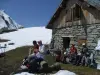
The Arc Pass, in the Lauzière Massif in Savoie, is an easy walk for nature lovers and departs from the village of Pussy (on the road to the Madeleine Pass). This walk can be enjoyed from June onwards. Take a picnic, water, a rucksack and mountain…
Located
34 km
away of Sainte-Foy-Tarentaise
Favourite
Itinerary
Arc Pass
8.0
1
Hike in La Léchère
Athletic
5:30, 10 km (change in altitude 800m)
Enjoy the landscapes of the Tarentaise valley, Beaufortain, Vanoise and the Lauzière massif.
Located
35 km
away of Sainte-Foy-Tarentaise
Favourite
Itinerary
La Douceraine
8.0
1
Hike in La Léchère
Easy
4:00, 9 km (change in altitude 490m)
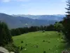
A route to discover the mountain level through forests and mountain pastures, with panoramas of the surrounding peaks.
Located
35 km
away of Sainte-Foy-Tarentaise
Favourite
Itinerary
The big forest
8.0
1
Hike in La Léchère
Easy
3:00, 7 km (change in altitude 380m)
A route in the great forest of Doucy, with a view of the Lauzière massif.
Located
35 km
away of Sainte-Foy-Tarentaise
Favourite
Itinerary
The Pissus
8.0
1
Hike in La Léchère
Easy
3:00, 7 km (change in altitude 527m)
Loop through the Lauzière massif which gives this place all its mineral dimension.
Located
37 km
away of Sainte-Foy-Tarentaise
Favourite
Itinerary
North Balcony
8.0
1
Hike in Chamonix-Mont-Blanc
Intermediate
2:30, 6 km (change in altitude 140m)
This hike is located on the north side of the valley, in the middle of the mountains. The points of departure and arrival are served by ski lifts. The route is offered in the most pleasant direction, depending on the view and the drop.
Located
37 km
away of Sainte-Foy-Tarentaise
Favourite
Itinerary
See more results
By continuing to browse our site, you are agreeing to the use of cookies to improve your experience and make targeted offers.
Find out more and make settings
Close
Your account
Continue with my email