Liven up your holidays!
Destination
State your preferences
Guide
Plan your stay
Your account
English
Français
Deutsch
Italiano
Español
Nederlands
Português
Русский
简体中文
日本語
0
0
0
Saint-Jean-la-Fouillouse
Menu
Tourism
Gastronomy
Outings
Activities
Events
Restaurants
Hotels
Vacation rentals
Bed & breakfasts
Campsites
Holiday insurance
Rental car
Train tickets
Plane tickets
Transfers
Holiday insurance
Holiday insurance
French courses
Romantic weekend
Family weekend
Cheap weekend
Unusual weekend
Find my position
Confirm
Discover
Tourist sites
Gastronomy
Cities & towns
Tourism labels
Themed itineraries
Custom itineraries
Photos
Panoramas
Tourism quiz
Going out
Leisure activities
Outings
Events
Restaurants
Stay
Hotels
Bed & breakfasts
Vacation rentals
Campsites
Travel
Rental car
Train tickets
Plane tickets
Holiday insurance
Information sheets
French courses
Outings
Around Saint-Jean-la-Fouillouse
Outings in Saint-Jean-la-Fouillouse
Ideas for walks and hikes in Saint-Jean-la-Fouillouse
Search
Cancel
35
outings found
Saint-Jean-la-Fouillouse
Change
Adjust destination
Town centre of Saint-Jean-la-Fouillouse
Locality - Former locality Belvezet (Mont Lozère et Goulet)
Locality - Former locality Chambon-le-Château (Bel-Air-Val-d'Ance)
Locality - Former locality Estables (Monts-de-Randon)
Locality - Former locality Fontanes (Naussac-Fontanes)
Locality - Former locality La Villedieu (Monts-de-Randon)
Locality - Former locality Laval-Atger (Saint Bonnet-Laval)
Locality - Former locality Naussac (Naussac-Fontanes)
Locality - Former locality Rieutort-de-Randon (Monts-de-Randon)
Locality - Former locality Saint-Bonnet-de-Montauroux (Saint Bonnet-Laval)
Locality - Former locality Saint-Symphorien (Bel-Air-Val-d'Ance)
Transport - Aerodrome of Langogne - Lespéron (Lespéron)
Transport - Train station of Allenc (Allenc)
Transport - Train station of Belvezet (Mont Lozère et Goulet)
Transport - Train station of Chapeauroux (Saint-Haon)
Transport - Train station of Langogne (Langogne)
Transport - Train station of Luc (Luc)
Information point - Tourist Office of Châteauneuf-de-Randon (Châteauneuf-de-Randon)
Information point - Tourist Office of Langogne (Langogne)
Information point - Tourist Office of Pradelles (Pradelles)
Information point - Visitor Information Centre of Auroux (Auroux)
Leisure centre - Golf Course of the Domaine de Barres (Langogne)
Leisure centre - Museum of the Cheval de Trait (Pradelles)
Leisure centre - Ski Resort Laubert - Plateau du Roy (Monts-de-Randon)
Leisure centre - Ski Resort Les Bouviers (Grandrieu)
Monument - Abbey of Mercoire (Cheylard-l'Évêque)
Monument - Castle of Luc (Luc)
Monument - Church Saint-Gervais-Saint-Protais (Langogne)
Monument - Church Saint-Haon (Saint-Haon)
Monument - Viaduct of Chapeauroux (Saint Bonnet-Laval)
Sort by distance from starting point
Sort by difficulty
Sort by change in altitude
Sort by duration
Sort by length in kilometres
Filter results
Open map
Outing type
Hike
Cycling itinerary
Horse ride
Other means of transport
Distance from starting point
Less than 10 km
from 10 km to 30 km
More than 30 km
Difficulty
Easy
Intermediate
Athletic
Change in altitude
Less than 200 m
from 200 m to 500 m
from 500 m to 1000 m
More than 1000 m
Duration
Less than 2 h
from 2 h to 4 h
More than 4 h
Kilometres
Less than 5 km
from 5 km to 10 km
from 10 km to 20 km
More than 20 km
Territory
Auvergne
Drôme-Ardèche
Languedoc-Roussillon
Massif Central
Filter results
Hide filters
Open map
Hide map
Outings in Saint-Jean-la-Fouillouse
Outings around Saint-Jean-la-Fouillouse
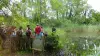
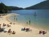
Tour of the lake of Mas d'Armand
8.0
2
Hike in Langogne
Easy
45 min, 3 km (change in altitude 0m)
Tower of the small reservoir of water on the lake of Naussac. Wildlife discovery trail, bird watching station.
Located
13.3 km
away of Saint-Jean-la-Fouillouse
Favourite
Itinerary
Garou Trail - PR 655
8.0
2
Hike in Cayres
Easy
1:30, 5 km (change in altitude 165m)
This forest circuit takes you to discover the blue jewel of the department: Lake Bouchet. Set off on the shores of the volcanic maar then gain height to embrace the Devès, the largest basaltic plateau in France.
Located
25 km
away of Saint-Jean-la-Fouillouse
Favourite
Itinerary
9.7
1
Hike in Cayres
Easy
2:00, 6 km (change in altitude 185m)
Located
25 km
away of Saint-Jean-la-Fouillouse
Favourite
Itinerary
Mont Recours and Bois Grand - PR 310
8.0
1
Hike in Cayres
Easy
2:30, 10 km (change in altitude 297m)
Under the imposing gaze of the turrets of the bell tower of the church of Cayres, set off to explore Mount Recours, a former volcano offering a panoramic view of the Devès and Velay mountains. An orientation table will allow you to locate these…
Located
27 km
away of Saint-Jean-la-Fouillouse
Favourite
Itinerary
Vermenouse Fountain - PR 312
8.0
1
Hike in Cayres
Intermediate
4:00, 14 km (change in altitude 257m)
An invitation to discover the Velay plateau, land of the green lens whose cultures can be seen along the way. The ocher tracks and the houses in volcanic breach will enhance the landscape along the circuit.
Located
27 km
away of Saint-Jean-la-Fouillouse
Favourite
Itinerary
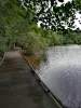
Tour of Villefort Lake
7.9
28
Hike in Villefort
Easy
2:30, 8 km (change in altitude 100m)
A pleasant 8 km walk around Villefort Lake.
Located
35 km
away of Saint-Jean-la-Fouillouse
Favourite
Itinerary
7.3
6
Hike in Cros-de-Géorand
Athletic
3:50, 10 km (change in altitude 505m)
Located
36 km
away of Saint-Jean-la-Fouillouse
Favourite
Itinerary
Path along the ridges of Mount Lozère
8.6
10
Hike in Pont de Montvert - Sud Mont Lozère
Easy
2:00, 5 km (change in altitude 158m)
Very beautiful signposted path over the high-altitude grassland which gradually rises to the Finiels summit, at an altitude of 1,699 metres. 360° viewpoint!
Located
38 km
away of Saint-Jean-la-Fouillouse
Favourite
Itinerary
Finiels Summit
8.4
8
Hike in Pont de Montvert - Sud Mont Lozère
Intermediate
4:00, 11 km (change in altitude 500m)
Walk to the summit of Mount Lozère and the Cevennes from Finiels.
Located
38 km
away of Saint-Jean-la-Fouillouse
Favourite
Itinerary
Chalias
9.0
5
Hike in Montpezat-sous-Bauzon
Intermediate
3:00, 7 km (change in altitude 300m)
This walk will offer you the chance to visit the Montpezat valley with a panoramic view over the village. You will pass through chestnut forests and hamlets. View over the hydroelectric plant, Poucheyrolles Castle, Gravenne.
Located
41 km
away of Saint-Jean-la-Fouillouse
Favourite
Itinerary
9.6
5
Hike in Aiguilhe
Easy
25 min, 1 km (change in altitude 51m)
Located
42 km
away of Saint-Jean-la-Fouillouse
Favourite
Itinerary
Between ridges and forests
8.0
1
Hike in Beaumont
Intermediate
2:30, 6 km (change in altitude 383m)
The discovery trail of the village of Beaumont is perched in the Ardèche Cévennes. A loop starting and finishing in the village, near the hostel, for superb landscapes! On a clear day, you can see the snow-capped Alps and Mont Ventoux to the…
Located
42 km
away of Saint-Jean-la-Fouillouse
Favourite
Itinerary
9.2
5
Hike in Thueyts
Intermediate
2:10, 5 km (change in altitude 363m)
Located
42 km
away of Saint-Jean-la-Fouillouse
Favourite
Itinerary
Greenway
9.0
4
Hike in Brives-Charensac
Easy
3:00, 50 km (change in altitude 100m)
The Greenway is an old railway line for walking or cycling. It takes you to the heart of the Loire Valley and the Mézenc Massif. On the way you will discover tunnels and a viaduct with a spectacular view.
Located
42 km
away of Saint-Jean-la-Fouillouse
Favourite
Itinerary
8.6
6
Hike in Sainte-Eulalie
Easy
2:10, 7 km (change in altitude 150m)
Located
45 km
away of Saint-Jean-la-Fouillouse
Favourite
Itinerary
5.8
14
Hike in Jaujac
Easy
1:25, 4 km (change in altitude 165m)
Located
45 km
away of Saint-Jean-la-Fouillouse
Favourite
Itinerary
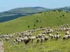
The lost trails
7.7
9
Hike in Bonnevaux
Intermediate
5:00, 8 km (change in altitude 400m)
Very beautiful walk, part of which follows an old sheep trail. Wooded sections, clear views from the summit (over Mount Lozère, the Vivarais Mountains, the Rhone valley and Mount Ventoux), valley floor with schist walls and chestnut trees.
Located
46 km
away of Saint-Jean-la-Fouillouse
Favourite
Itinerary
Outing to Les Esperelles and Ancise Pass
6.5
6
Hike in Ventalon en Cévennes
Intermediate
3:00, 12 km (change in altitude 300m)
A pleasant outing along the old railway line to the hamlet of Les Esperelles and Ancise Pass. Points of interest: typical Cevenol hamlet, attractive views over the valley and passage through three of the former railway line's tunnels.
Located
47 km
away of Saint-Jean-la-Fouillouse
Favourite
Itinerary
Upper Blajoux Valley
6.0
23
Hike in Sanilhac
Easy
1:30, 4 km (change in altitude 100m)
Walk through the chestnut grove along old paved paths, cross the hamlet of Marinier and an old bridge over the Blajoux stream.
Located
48 km
away of Saint-Jean-la-Fouillouse
Favourite
Itinerary
Basilica of Our Lady (Notre-Dame) and megalithic bridge
7.8
7
Village visit in Lablachère
Easy
1:15, 5 km (change in altitude 0m)
This pleasant walk will take you from the Basilica of Our Lady of Good Help (Notre-Dame de Bonsecours) to La Jaujon, via the megalithic bridge…
Located
49 km
away of Saint-Jean-la-Fouillouse
Favourite
Itinerary
Winemaker's Trail
8.1
15
Hike in Lablachère
Easy
2:30, 8 km (change in altitude 80m)
Signposted winemaker's trail departing from the Lablachère wine cooperative. There is a large board presenting the itinerary at the car park. This path will lead you through the vineyards planted on terraces where Chatus, the emblematic grape…
Located
50 km
away of Saint-Jean-la-Fouillouse
Favourite
Itinerary
Around the Loire
5.6
11
Hike in Lavoûte-sur-Loire
Easy
1:30, 6 km (change in altitude 0m)
Small family walk around the Loire and the castle. Along the loop of the Loire, which gave the village its name, Lavoûte-sur-Loire (of " volta ", Latin loop). In this same place eventually Gorge Peyredeyre, that opens the flood plain of the…
Located
50 km
away of Saint-Jean-la-Fouillouse
Favourite
Itinerary
Corniche Casteljau
8.0
1
Hike in Casteljau
Easy
1:30, 4 km (change in altitude 388m)
Pretty hiking in the woods Païolive, at any age, mixing ride under oaks and on the limestone plateau. Great view of the Chassezac.
Located
51 km
away of Saint-Jean-la-Fouillouse
Favourite
Itinerary
7.4
12
Hike in Vallées-d'Antraigues-Asperjoc
Intermediate
3:55, 8 km (change in altitude 752m)
Located
53 km
away of Saint-Jean-la-Fouillouse
Favourite
Itinerary
The Corboeuf Ravines
7.4
29
Hike in Rosières
Easy
1:30, 5 km (change in altitude 0m)
The Corboeuf Ravines, also known as “The Auvergne Colorado”: a site with a remarkable geological past.
Located
53 km
away of Saint-Jean-la-Fouillouse
Favourite
Itinerary
See more results
By continuing to browse our site, you are agreeing to the use of cookies to improve your experience and make targeted offers.
Find out more and make settings
Close
Your account
Continue with my email