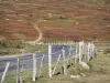
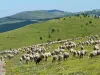
Very beautiful signposted path over the high-altitude grassland which gradually rises to the Finiels summit, at an altitude of 1,699 metres. 360° viewpoint!
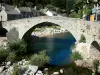
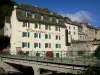
Le Pont-de-Montvert


Very beautiful signposted path over the high-altitude grassland which gradually rises to the Finiels summit, at an altitude of 1,699 metres. 360° viewpoint!

| Department | Lozère |
|---|---|
| Departure municipality | Pont de Montvert - Sud Mont Lozère |
| Outing type | Hike |
| Difficulty | Easy |
| Duration | 2:00 |
| Recommended period | from may to november |
| Environment | Mountains |
| Kilometres | 5 km |
| Altitude upon departure | 1541m |
| Change in altitude | 158m |
From Pont-de-Montvert or Finiels, take the D20 road towards Le Bleymard, climb up to the Finiels Pass and stop at the car park.
At the pass, to find the sign for the start of the walk, follow the D20 for 100 m. After the small bridge, the highly visible path leaves the road and gradually climbs up to a higher pass, then a first summit and the Finiels summit, with three orientation tables and a Maltese cross on a stone. It is possible to descend along other clearly visible routes.