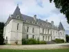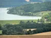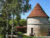


Departure: parking Marac - Signposting: yellow and yellow - Duration on foot: 5h - Duration mountain bike: 2h30 - difficult level - From the parking of the village hall and the dovecote Marac, take the direction from Ormancey by the road D 143. Cross the road of Arc-en-Barrois with caution while making a hook by the "old" road. In Ormancey, notice the roofs of the houses in violin tiles. Then go towards the water tower, turning left in front of the church and then right. Go back behind the church and turn left. Pass in front of the old cheese factory. Continue on D 288 and take the first road on the right. Enter the state forest *. Cross the forest road of Les Closiers Continue straight west for three kilometers. Enter Ternat. After the Forest House, turn right. Do not miss the two wash houses. Take the path on the right. At the road, turn right and follow the road. At the crossroads of 5 paths, we arrive at the Intersection of the Circuit des Templiers. Take the forest road on the right and then follow the Templar circuit to Chenot pond Marac. Stay on the main road always going straight up to the D 3 that will cross very carefully. Go in front about 250 meters then take the forest line right through the Marac Woods. Go straight and at the next intersection, turn left, then immediately after right. Continue to the last logging line that you will take on the left. At the small road, turn right and then left at the edge of meadow. Go to the fishing pond for a look and possibly a well-deserved break. Retrace your steps and take the small asphalt road then the D 102 which brings you back to Marac. * Attention: The forest is also delimited by 2 yellow traises. To avoid any problem, in doubt always continue on the path in front of you. The crossing of the forest is done by a path without any change of direction until Ternat. All the tourist info on
Langres