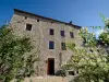
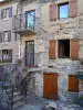
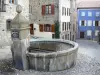
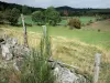
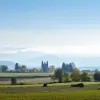
The common Saint-Jean-la-Fouillouse formerly Saint-Jean-la-Chan, is named after the creek that runs through Fouillouse and takes its source. It is situated on the foothills of the Margeride, at an altitude ranging from 1000 to 1350 meters.


Favourite
The common Saint-Jean-la-Fouillouse formerly Saint-Jean-la-Chan, is named after the creek that runs through Fouillouse and takes its source. It is situated on the foothills of the Margeride, at an altitude ranging from 1000 to 1350 meters.
| Municipality | Saint-Jean-la-Fouillouse |
|---|---|
| Postcode | 48170 |
| Latitude | 44.6998770 (N 44° 41’ 60”) |
| Longitude | 3.6913200 (E 3° 41’ 29”) |
| Altitude | From 1086m to 1348m |
| Surface area | 29.27 km² |
| Population | 152 inhabitants |
| Density | 5 inhabitants/km² |
| Prefecture | Mende (39 km, 42 min) |
| Insee code | 48160 |
| Intercommunality | CC Randon - Margeride |
| Department | Lozère |
| Territories | Languedoc-Roussillon, Massif Central |
| Region | Occitanie |
| Pierrefiche | 5.8 km (10 min) |
|---|---|
| Chastanier | 7 km (12 min) |
| Saint-Sauveur-de-Ginestoux | 8 km (15 min) |
| Rocles | 9.6 km (17 min) |
| Châteauneuf-de-Randon | 10.3 km (18 min) |
| Auroux | 10.8 km (17 min) |
| La Panouse | 11.5 km (19 min) |
| Chaudeyrac | 11.8 km (23 min) |
| Arzenc-de-Randon | 13.9 km (20 min) |
| Grandrieu | 14.8 km (17 min) |
| Naussac-Fontanes | 15.8 km (24 min) |
| Saint-Flour-de-Mercoire | 17.2 km (26 min) |
| Langogne | 17.3 km (26 min) |
| Montbel | 19.1 km (25 min) |
| Last name | Activity type | Rate | City |
|---|---|---|---|
 | Arts and Crafts | Free | Florac Trois Rivières (41 km) |
 | Entertainment | 12 € | Sanilhac (45 km) |
 | Sports sensations | 42 € to 70 € | Sanilhac (48 km) |
 | Sports sensations | 35 € | La Canourgue (48 km) |
 | Sports sensations | 16 € | Chassagnes (50 km) |
| Last name | Outing type | Difficulty | Duration | Departure municipality |
|---|---|---|---|---|
 | Hike | Easy | 45 min | Langogne (13.3 km) |
 | Hike | Easy | 1:30 | Cayres (25 km) |
 | Hike | Easy | 2:00 | Cayres (25 km) |
 | Hike | Easy | 2:30 | Cayres (27 km) |
 | Hike | Intermediate | 4:00 | Cayres (27 km) |