


Favourite
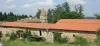
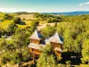
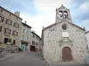
Allègre
| Municipality | La Chapelle-Bertin |
|---|---|
| Postcode | 43270 |
| Latitude | 45.2188570 (N 45° 13’ 8”) |
| Longitude | 3.6493740 (E 3° 38’ 58”) |
| Altitude | From 680m to 1136m |
| Surface area | 11.29 km² |
| Population | 48 inhabitants |
| Density | 4 inhabitants/km² |
| Prefecture | Le Puy-en-Velay (34 km, 37 min) |
| Insee code | 43057 |
| Intercommunality | CA du Puy-en-Velay |
| Department | Haute-Loire |
| Territories | Auvergne, Massif Central |
| Region | Auvergne-Rhône-Alps |
| Varennes-Saint-Honorat | 6 km (13 min) |
|---|---|
| Allègre | 7 km (11 min) |
| Josat | 7.7 km (13 min) |
| Saint-Pal-de-Senouire | 7.9 km (12 min) |
| Monlet | 9.6 km (15 min) |
| Sainte-Marguerite | 10.2 km (17 min) |
| Céaux-d'Allègre | 11.4 km (18 min) |
| Fix-Saint-Geneys | 12 km (20 min) |
| Sembadel | 12.4 km (18 min) |
| Jax | 12.8 km (22 min) |
| Sainte-Eugénie-de-Villeneuve | 13 km (23 min) |
| Mazerat-Aurouze | 14.1 km (23 min) |
| Collat | 14.1 km (21 min) |
| Connangles | 14.8 km (20 min) |
| Last name | Activity type | Rate | City |
|---|---|---|---|
 | Sports sensations | 50 € to 60 € | Vieille-Brioude (20 km) |
| Last name | Outing type | Difficulty | Duration | Departure municipality |
|---|---|---|---|---|
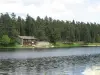
 | Hike | Intermediate | 1:40 | Allègre (5.4 km) |
 | Hike | Easy | 1:30 | La Chaise-Dieu (11.9 km) |
 | Hike | Intermediate | 3:00 | La Chaise-Dieu (11.9 km) |
 | Hike | Easy | 2:00 | Champagnac-le-Vieux (19.3 km) |
 | Car itinerary | Easy | 2:00 | Vorey (21 km) |