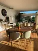


Favourite
Lorraine faience pottery
| Municipality | Farébersviller |
|---|---|
| Postcode | 57450 |
| Tourism label | ") |
| Latitude | 49.1165600 (N 49° 6’ 60”) |
| Longitude | 6.8675670 (E 6° 52’ 3”) |
| Altitude | From 219m to 321m |
| Surface area | 6.88 km² |
| Population | 5453 inhabitants |
| Density | 792 inhabitants/km² |
| Prefecture | Metz (56 km, 37 min) |
| Insee code | 57207 |
| Intercommunality | CC de Freyming-Merlebach |
| Department | Moselle |
| Territory | Lorraine |
| Region | Great East |
| Henriville | 2.7 km (5 min) |
|---|---|
| Théding | 3.1 km (7 min) |
| Seingbouse | 3.1 km (5 min) |
| Cocheren | 4 km (5 min) |
| Farschviller | 4.9 km (7 min) |
| Betting | 5.2 km (7 min) |
| Diebling | 5.7 km (7 min) |
| Béning-lès-Saint-Avold | 5.9 km (10 min) |
| Tenteling | 6.3 km (9 min) |
| Folkling | 6.3 km (10 min) |
| Loupershouse | 6.5 km (8 min) |
| Cappel | 6.6 km (10 min) |
| Guenviller | 6.9 km (11 min) |
| Rosbruck | 7.1 km (11 min) |
| Morsbach | 7.1 km (11 min) |
| Transport |
|---|
| Last name | Outing type | Difficulty | Duration | Departure municipality |
|---|---|---|---|---|
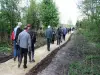 | Hike | Easy | 30 min | Ham-sous-Varsberg (17.6 km) |
 | Cycling itinerary | Easy | 4:30 | Frauenberg (19.1 km) |
 | Hike | Easy | 2:00 | Berviller-en-Moselle (23 km) |
| Cycling itinerary | Easy | 4:00 | Lorentzen (29 km) |
| Hike | Easy | 2:00 | Diemeringen (30 km) |