
Favourite
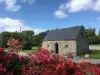
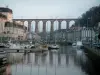
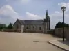
Morlaix
| Municipality | Botsorhel |
|---|---|
| Postcode | 29650 |
| Latitude | 48.5270280 (N 48° 31’ 37”) |
| Longitude | -3.6417600 (W 3° 38’ 30”) |
| Altitude | From 92m to 265m |
| Surface area | 25.64 km² |
| Population | 440 inhabitants |
| Density | 17 inhabitants/km² |
| Prefecture | Quimper (87 km, 1:25) |
| Insee code | 29014 |
| Intercommunality | CA Morlaix Communauté |
| Department | Finistère |
| Region | Brittany |
| Lannéanou | 5.7 km (10 min) |
|---|---|
| Plouégat-Moysan | 6.7 km (12 min) |
| Guerlesquin | 6.9 km (11 min) |
| Plouigneau | 8.2 km (14 min) |
| Plougras | 9.4 km (14 min) |
| Trémel | 10.3 km (14 min) |
| Plougonven | 11.2 km (16 min) |
| Plounérin | 11.5 km (18 min) |
| Scrignac | 13.8 km (18 min) |
| Bolazec | 13.9 km (19 min) |
| Plufur | 14.1 km (20 min) |
| Lohuec | 16.2 km (23 min) |
| Garlan | 16.2 km (25 min) |
| Last name | Outing type | Difficulty | Duration | Departure municipality |
|---|---|---|---|---|
 | Hike | Easy | 55 min | Plougras (8.4 km) |
 | Hike | Easy | 2:15 | Plounérin (8.6 km) |
 | Hike | Intermediate | 3:05 | Bolazec (10.1 km) |
 | Hike | Easy | 4:30 | Scrignac (10.7 km) |
 | Hike | Intermediate | 2:35 | Loguivy-Plougras (12.5 km) |