
Favourite
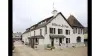
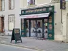
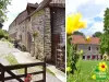
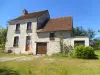
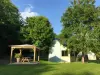
Mortagne-au-Perche
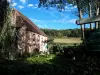
| Municipality | Boëcé |
|---|---|
| Postcode | 61560 |
| Latitude | 48.5131550 (N 48° 30’ 47”) |
| Longitude | 0.4497430 (E 0° 26’ 59”) |
| Altitude | From 164m to 224m |
| Surface area | 2.41 km² |
| Population | 128 inhabitants |
| Density | 53 inhabitants/km² |
| Prefecture | Alençon (33 km, 34 min) |
| Insee code | 61048 |
| Intercommunality | CC du Pays de Mortagne au Perche |
| Department | Orne |
| Territory | Perche |
| Region | Normandy |
| La Mesnière | 2.1 km (4 min) |
|---|---|
| Courgeoût | 4 km (7 min) |
| Buré | 4.8 km (6 min) |
| Coulimer | 5.1 km (8 min) |
| Coulonges-sur-Sarthe | 5.3 km (10 min) |
| Saint-Jouin-de-Blavou | 7.8 km (12 min) |
| Mortagne-au-Perche | 8.2 km (8 min) |
| Laleu | 8.5 km (15 min) |
| Saint-Quentin-de-Blavou | 8.5 km (13 min) |
| Parfondeval | 8.7 km (14 min) |
| Saint-Julien-sur-Sarthe | 8.8 km (9 min) |
| Bazoches-sur-Hoëne | 8.9 km (10 min) |
| Saint-Léger-sur-Sarthe | 9.1 km (8 min) |
| Le Mêle-sur-Sarthe | 9.6 km (10 min) |
| Last name | Activity type | Rate | City |
|---|---|---|---|
 | Sports sensations | 22 € to 75 € | Fontaine-Simon (42 km) |
| Last name | Outing type | Difficulty | Duration | Departure municipality |
|---|---|---|---|---|
 | Hike | Easy | 3:25 | Saint-Longis (19.5 km) |
 | Hike | Easy | 3:45 | Jauzé (34 km) |
 | Hike | Easy | 55 min | Bonnétable (38 km) |
 | Hike | Intermediate | 2:45 | Nonvilliers-Grandhoux (56 km) |