
Favourite
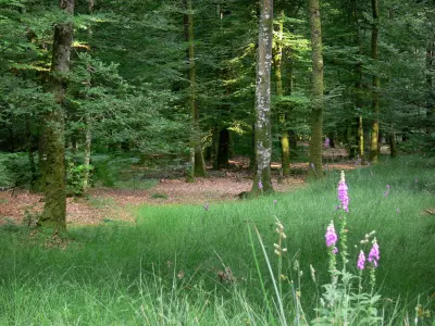
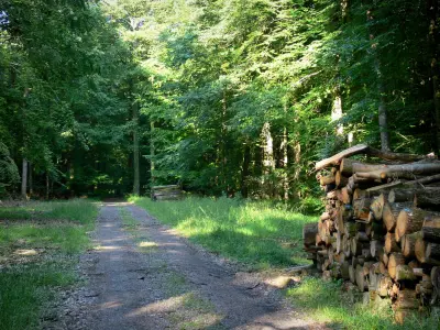
Perseigne Forest
| Municipality | Saint-Julien-sur-Sarthe |
|---|---|
| Postcode | 61170 |
| Latitude | 48.4909780 (N 48° 29’ 28”) |
| Longitude | 0.3572220 (E 0° 21’ 26”) |
| Altitude | From 141m to 197m |
| Surface area | 16.39 km² |
| Population | 708 inhabitants |
| Density | 43 inhabitants/km² |
| Prefecture | Alençon (26 km, 28 min) |
| Insee code | 61412 |
| Intercommunality | CC de la Vallée de la Haute Sarthe |
| Department | Orne |
| Territory | Perche |
| Region | Normandy |
| Barville | 1.4 km (3 min) |
|---|---|
| Le Mêle-sur-Sarthe | 3.3 km (6 min) |
| Blèves | 4.4 km (6 min) |
| Vidai | 4.6 km (7 min) |
| Saint-Léger-sur-Sarthe | 4.7 km (10 min) |
| Buré | 6.5 km (10 min) |
| Marchemaisons | 6.9 km (7 min) |
| Saint-Aubin-d'Appenai | 6.9 km (11 min) |
| Les Aulneaux | 7.3 km (10 min) |
| Saint-Quentin-de-Blavou | 7.4 km (9 min) |
| Coulonges-sur-Sarthe | 7.8 km (14 min) |
| Laleu | 8.6 km (13 min) |
| Boëcé | 8.8 km (9 min) |
| Pervenchères | 8.8 km (12 min) |
| Last name | Activity type | Rate | City |
|---|---|---|---|
 | Sports sensations | 22 € to 75 € | Fontaine-Simon (49 km) |
| Last name | Outing type | Difficulty | Duration | Departure municipality |
|---|---|---|---|---|
 | Hike | Easy | 3:25 | Saint-Longis (15.8 km) |
 | Hike | Easy | 3:45 | Jauzé (31 km) |
 | Hike | Easy | 55 min | Bonnétable (36 km) |


