Favourite
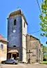
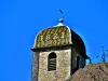
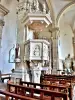
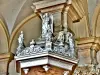
Besançon


| Municipality | Amagney |
|---|---|
| Postcode | 25220 |
| Latitude | 47.3068020 (N 47° 18’ 24”) |
| Longitude | 6.1537230 (E 6° 9’ 13”) |
| Altitude | From 253m to 504m |
| Surface area | 13.13 km² |
| Population | 947 inhabitants |
| Density | 72 inhabitants/km² |
| Prefecture | Besançon (16 km, 22 min) |
| Insee code | 25014 |
| Intercommunality | CU Grand Besançon Métropole |
| Department | Doubs |
| Territories | Franche-Comté, Jura mountains |
| Region | Burgundy-Franche-Comté |
| Novillars | 4.1 km (6 min) |
|---|---|
| Vaire | 4.2 km (8 min) |
| Marchaux-Chaudefontaine | 4.9 km (10 min) |
| Roche-lez-Beaupré | 6.1 km (8 min) |
| Champoux | 6.5 km (13 min) |
| Deluz | 7.6 km (11 min) |
| Roulans | 7.6 km (9 min) |
| Chalèze | 8.9 km (12 min) |
| Braillans | 9.1 km (18 min) |
| Pouligney-Lusans | 9.8 km (11 min) |
| Châtillon-Guyotte | 10.2 km (17 min) |
| Vennans | 10.5 km (13 min) |
| Thise | 10.6 km (14 min) |
| Laissey | 11 km (14 min) |


| Last name | Activity type | Rate | City |
|---|---|---|---|
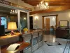
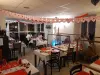
 | Entertainment | 84 € to 110 € | Besançon (12.4 km) |
| Last name | Outing type | Difficulty | Duration | Departure municipality |
|---|---|---|---|---|
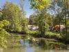
 | Hike | Easy | 6:00 | Devecey (10.4 km) |
 | Hike | Athletic | 5:05 | Fretigney-et-Velloreille (25 km) |
 | Hike | Intermediate | 1:20 | Bucey-lès-Gy (26 km) |
 | Hike | Easy | 2:35 | Bucey-lès-Gy (27 km) |
 | Hike | Easy | 1:00 | Pays-de-Clerval (28 km) |