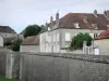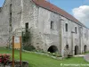

Departure: Place of the town hall of Leffonds - Marking: yellow and yellow - Duration on foot: 5h30 - Duration in VTT: 3h - difficult level - In Leffonds, to take the direction of Arc en Barrois then, the first street on the right which goes down at the laundry and continues with a steep path on the left. Once back on the road, turn left, then, after the last houses of the village, turn right behind the raspberries. Turn right on the D 102 and continue on your right, along a path of farmland across the fields. Turn left to pass under the highway and join the hamlet of Mormant, seat of a former commandery of Templiers. Continue on the left towards Bugnières; you are on an old Roman road whose vestiges still remain. After 2 km, turn right to enter the Fays wood. There, continue straight up to a fence that you have to go along. At the next intersection, turn left and continue along this pen to the edge of the woods. From there, continue straight on a farm road that leads to the village of Bugnières. A stop is needed then to taste the "Ruby of Currants". Cross the village, and silo, take the path on the left, cross the D 3 and continue straight to reach the Grands Bois. Near the forest road, turn left and take a path that takes you back to the D 3. Cross it again, and after 200 meters, turn right on a forest path that will take you through the wood of Marac. At the edge of the woods, turn left along the Perouse valley then turn right to reach Chenot pond. From there, walk along the Vèvres forest to the forest road and follow it to the right to join the Marac road. Turn left and pass a second time under the highway. At the old farm Rosery, turn left and climb in the woods of Haut Mont. At the crossroads, turn right and then turn left. Continue straight ahead and, about 500 m, turn right before continuing in front to get out of the woods. Then follow the highway for 50 m and then turn right and join Leffonds through fields. All the tourist info on
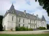
Arc-en-Barrois