Liven up your holidays!
Destination
State your preferences
Guide
Plan your stay
Your account
English
Français
Deutsch
Italiano
Español
Nederlands
Português
Русский
简体中文
日本語
0
0
0
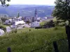
Rignac
Menu
Tourism
Gastronomy
Outings
Activities
Events
Restaurants
Hotels
Vacation rentals
Bed & breakfasts
Campsites
Holiday insurance
Rental car
Train tickets
Plane tickets
Transfers
Holiday insurance
Holiday insurance
French courses
Romantic weekend
Family weekend
Cheap weekend
Unusual weekend
Find my position
Confirm
Discover
Tourist sites
Gastronomy
Cities & towns
Tourism labels
Themed itineraries
Custom itineraries
Photos
Panoramas
Tourism quiz
Going out
Leisure activities
Outings
Events
Restaurants
Stay
Hotels
Bed & breakfasts
Vacation rentals
Campsites
Travel
Rental car
Train tickets
Plane tickets
Holiday insurance
Information sheets
French courses
Outings
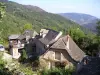
Around Rignac
Outings in Rignac
Ideas for walks and hikes in Rignac
Search
Cancel
37
outings found
Rignac
Change
Adjust destination
Town centre of Rignac
Locality - Former locality Balsac (Druelle Balsac)
Locality - Former locality La Bastide-l'Évêque (Le Bas Ségala)
Transport - Airport of Rodez - Marcillac (Salles-la-Source)
Transport - Train station of Aubin (Aubin)
Transport - Train station of Cransac (Cransac)
Transport - Train station of Marcillac-Vallon (Marcillac-Vallon)
Transport - Train station of Nuces (Valady)
Information point - Tourist Office of Rignac
Information point - Tourist Office of Cransac (Cransac)
Information point - Tourist Office of Decazeville (Decazeville)
Information point - Tourist Office of Marcillac-Vallon (Marcillac-Vallon)
Information point - Tourist Office of Montbazens (Montbazens)
Information point - Tourist Office of Rieupeyroux (Rieupeyroux)
Information point - Visitor Information Centre of Lanuéjouls (Lanuéjouls)
Leisure centre - Animal Park of Pradinas (Pradinas)
Leisure centre - Museum of Géologie Pierre Vetter (Decazeville)
Leisure centre - Museum of the Traditions agricoles (Pradinas)
Monument - Bridge of Belcastel (Belcastel)
Monument - Castle of Belcastel (Belcastel)
Monument - Castle of Bournazel (Bournazel)
Monument - Castle of Panat (Clairvaux-d'Aveyron)
Monument - Castle of the Roc d'Anglars (Belcastel)
Monument - Church Notre-Dame des Mines (Aubin)
Monument - Church Saint-Blaise (Aubin)
Monument - Church Saint-Martial (Rieupeyroux)
Monument - Church of Belcastel (Belcastel)
Monument - Fort of Aubin (Aubin)
Monument - Memorial of the Plateau des Forges du Gua (Aubin)
Performance hall - Espace André Jarlan
Sort by distance from starting point
Sort by difficulty
Sort by change in altitude
Sort by duration
Sort by length in kilometres
Filter results
Open map
Outing type
Hike
Cycling itinerary
Horse ride
Other means of transport
Distance from starting point
Less than 10 km
from 10 km to 30 km
More than 30 km
Difficulty
Easy
Intermediate
Athletic
Change in altitude
Less than 200 m
from 200 m to 500 m
from 500 m to 1000 m
More than 1000 m
Duration
Less than 2 h
from 2 h to 4 h
More than 4 h
Kilometres
Less than 5 km
from 5 km to 10 km
from 10 km to 20 km
More than 20 km
Territory
Auvergne
Massif Central
Midi-Pyrénées
Quercy
Filter results
Hide filters
Open map
Hide map
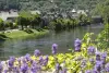
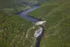
Outings in Rignac
Outings around Rignac
Municipality of Tayrac: from the plateau to the valley
7.3
5
Hike in Tayrac
Easy
2:30, 8 km (change in altitude 230m)
A micro region with a complex but very pleasant and attractive relief to be enjoyed when the weather is fine.
Located
23 km
away of Rignac
Favourite
Itinerary
Around Malepeyre
7.8
5
Hike in Capdenac-Gare
Easy
1:30, 4 km (change in altitude 50m)
Small easy walk with a low gradient (rising Verdier) on a path of earth and stones. You can contemplate the valley of Saint-Julien in Capdenac High, from the Cross of Verdier. Thank you to respect nature. Good ride!
Located
24 km
away of Rignac
Favourite
Itinerary
8.4
3
Hike in Espeyrac
Intermediate
2:10, 5 km (change in altitude 350m)
Located
29 km
away of Rignac
Favourite
Itinerary
9.0
2
Hike in Espeyrac
Intermediate
1:45, 4 km (change in altitude 274m)
Located
29 km
away of Rignac
Favourite
Itinerary
9.6
1
Hike in Espeyrac
Intermediate
2:55, 7 km (change in altitude 443m)
Located
29 km
away of Rignac
Favourite
Itinerary
Laurélie, Bor and Bar
6.3
5
Village visit in Bor-et-Bar
Easy
3:00, 10 km (change in altitude 200m)
Several solutions, a large loop or a smaller loop. You can leave your car in Bar if you want to follow a short loop, and leave another one in Laurélie, starting point. In Laurélie, climb up (signposted) towards Bor along the path through the…
Located
29 km
away of Rignac
Favourite
Itinerary
Pressoir needle
9.0
2
Hike in Figeac
Easy
2:00, 5 km (change in altitude 190m)
Discover from Aiguille du Pressoir a magnificent panorama of the city of Art and History of Figeac!
Located
30 km
away of Rignac
Favourite
Itinerary
8.6
2
Hike in Golinhac
Intermediate
4:00, 10 km (change in altitude 585m)
Located
32 km
away of Rignac
Favourite
Itinerary
8.0
3
Hike in Golinhac
Intermediate
2:35, 10 km (change in altitude 22m)
Located
32 km
away of Rignac
Favourite
Itinerary
9.0
3
Hike in Le Fel
Intermediate
2:05, 6 km (change in altitude 229m)
Located
32 km
away of Rignac
Favourite
Itinerary
9.0
3
Hike in Le Fel
Intermediate
3:20, 8 km (change in altitude 533m)
Located
32 km
away of Rignac
Favourite
Itinerary
8.4
1
Hike in Le Fel
Intermediate
4:00, 6 km (change in altitude 982m)
Located
32 km
away of Rignac
Favourite
Itinerary
9.2
4
Hike in Golinhac
Intermediate
2:40, 6 km (change in altitude 459m)
Located
33 km
away of Rignac
Favourite
Itinerary
9.0
2
Hike in Entraygues-sur-Truyère
Athletic
5:45, 14 km (change in altitude 869m)
Located
34 km
away of Rignac
Favourite
Itinerary
8.0
4
Hike in Entraygues-sur-Truyère
Intermediate
2:40, 6 km (change in altitude 435m)
Located
34 km
away of Rignac
Favourite
Itinerary
9.4
4
Hike in Entraygues-sur-Truyère
Intermediate
5:05, 11 km (change in altitude 910m)
Located
34 km
away of Rignac
Favourite
Itinerary
7.6
5
Hike in Entraygues-sur-Truyère
Easy
20 min, 1 km (change in altitude 21m)
Located
34 km
away of Rignac
Favourite
Itinerary
9.1
3
Hike in Entraygues-sur-Truyère
Intermediate
2:55, 7 km (change in altitude 457m)
Located
35 km
away of Rignac
Favourite
Itinerary
8.6
3
Hike in Entraygues-sur-Truyère
Intermediate
2:50, 6 km (change in altitude 514m)
Located
35 km
away of Rignac
Favourite
Itinerary
8.5
4
Hike in Campouriez
Intermediate
4:35, 11 km (change in altitude 711m)
Located
40 km
away of Rignac
Favourite
Itinerary
8.6
2
Hike in Saint-Hippolyte
Intermediate
2:55, 7 km (change in altitude 449m)
Located
40 km
away of Rignac
Favourite
Itinerary
9.5
2
Hike in Saint-Hippolyte
Intermediate
1:20, 3 km (change in altitude 233m)
Located
40 km
away of Rignac
Favourite
Itinerary
Malecargue Fountain Circuit
8.9
11
Hike in Limogne-en-Quercy
Intermediate
3:15, 10 km (change in altitude 0m)
Perfect walk for understanding the specific features of the Limogne Causse: flora, buildings, characteristics, etc.
Located
41 km
away of Rignac
Favourite
Itinerary
9.8
4
Hike in Saint-Hippolyte
Intermediate
3:20, 9 km (change in altitude 412m)
Located
41 km
away of Rignac
Favourite
Itinerary
9.1
4
Hike in Saint-Amans-des-Cots
Intermediate
3:10, 9 km (change in altitude 361m)
Located
43 km
away of Rignac
Favourite
Itinerary
See more results
By continuing to browse our site, you are agreeing to the use of cookies to improve your experience and make targeted offers.
Find out more and make settings
Close
Your account
Continue with my email