Favourite
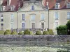
Basket-making in Fayl-Billot
| Municipality | Rivières-le-Bois |
|---|---|
| Postcode | 52600 |
| Latitude | 47.7370850 (N 47° 44’ 14”) |
| Longitude | 5.4421710 (E 5° 26’ 32”) |
| Surface area | 7.14 km² |
| Population | 69 inhabitants |
| Density | 9 inhabitants/km² |
| Prefecture | Chaumont (70 km, 55 min) |
| Insee code | 52424 |
| Intercommunality | CC des Savoir-Faire |
| Department | Haute-Marne |
| Territory | Champagne-Ardenne |
| Region | Great East |
| Grandchamp | 2.6 km (6 min) |
|---|---|
| Violot | 3.7 km (7 min) |
| Saint-Broingt-le-Bois | 4.6 km (9 min) |
| Palaiseul | 4.7 km (7 min) |
| Maâtz | 5.3 km (12 min) |
| Le Pailly | 6.8 km (8 min) |
| Coublanc | 6.9 km (13 min) |
| Grenant | 7.4 km (11 min) |
| Heuilley-le-Grand | 8 km (12 min) |
| Chassigny | 8.8 km (15 min) |
| Chalindrey | 8.8 km (11 min) |
| Saulles | 9 km (14 min) |
| Noidant-Chatenoy | 9.9 km (11 min) |
| Last name | Outing type | Difficulty | Duration | Departure municipality |
|---|---|---|---|---|
 | Cycling itinerary | Easy | 1:40 | Grandchamp (1.7 km) |
 | Cycling itinerary | Intermediate | 2:55 | Chalindrey (7.5 km) |
 | Hike | Intermediate | 7:30 | Chalindrey (7.6 km) |
 | Cycling itinerary | Easy | 1:30 | Villegusien-le-Lac (8.6 km) |
 | Cycling itinerary | Easy | 1:45 | Villegusien-le-Lac (8.7 km) |