Logging roads for mountain biking.
Church (old abbey).
| Municipality | Moiremont |
|---|---|
| Postcode | 51800 |
| Latitude | 49.1342340 (N 49° 8’ 3”) |
| Longitude | 4.8879770 (E 4° 53’ 17”) |
| Surface area | 16.98 km² |
| Population | 201 inhabitants |
| Density | 11 inhabitants/km² |
| Prefecture | Châlons-en-Champagne (53 km, 41 min) |
| Insee code | 51370 |
| Intercommunality | CC de l'Argonne Champenoise |
| Department | Marne |
| Territory | Champagne-Ardenne |
| Region | Great East |
| La Neuville-au-Pont | 2.8 km (5 min) |
|---|---|
| Vienne-la-Ville | 5.1 km (7 min) |
| Florent-en-Argonne | 5.2 km (8 min) |
| Sainte-Menehould | 5.5 km (8 min) |
| Maffrécourt | 6.2 km (12 min) |
| Chaudefontaine | 6.2 km (11 min) |
| Le Claon | 6.9 km (11 min) |
| Saint-Thomas-en-Argonne | 7.6 km (10 min) |
| Le Neufour | 8.2 km (12 min) |
| Vienne-le-Château | 8.6 km (10 min) |
| Verrières | 9 km (16 min) |
| Dommartin-sous-Hans | 9.4 km (17 min) |
| Berzieux | 9.6 km (12 min) |
Logging roads for mountain biking.
Church (old abbey).
Village festival in July: Mass pot apiary, ride, show, balloon launch, ball ...
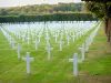
Sites of battles 1914-1918 (free of the Crown Prince, Ride High, Kaiser Tunnel).
| Last name | Activity type | Rate | City |
|---|---|---|---|
 | Entertainment | 69 € to 119 € | Ancemont (39 km) |
| Last name | Outing type | Difficulty | Duration | Departure municipality |
|---|---|---|---|---|
 | Cycling itinerary | Intermediate | 2:20 | Sainte-Menehould (4.7 km) |
 | All-terrain bike itinerary | Easy | 3:30 | Sainte-Menehould (5 km) |
 | Hike | Easy | 2:30 | Vouziers (32 km) |
 | Hike | Easy | 4:55 | Ancemont (39 km) |
 | All-terrain bike itinerary | Intermediate | 2:45 | Châlons-en-Champagne (44 km) |