Liven up your holidays!

Lus-la-Croix-Haute

Tourism, holidays & weekends guide in the Drôme

Lus-la-Croix-Haute - Tourism, holidays & weekends guide in the Drôme
8.7
6

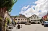
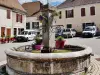
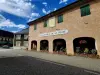
Small village of the Drôme, halfway between Grenoble and Sisteron, Lus-la-Croix-Haute takes place in the heart of the Regional Natural Park of Vercors, more than 160 kilometers from Valence. Located in the Lus Valley, it is at the crossroads between Trièves, Dévoluy and Diois.

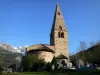
Former property of the seigniory of Trièves in the early twelfth century, Lus-la-Croix-Haute belonged then to the Counts of Die. Located at more than 1,100 meters above sea level, it remains today appreciated for its gastronomic heritage based on tourtons, ravioles and other pies of all kinds.

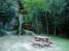
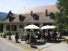
The town seduces mainly by its unique and entirely preserved natural heritage, ideal to spend a few days of holidays in the great outdoors, far from the tumult city. Sports and outdoor life enthusiasts can enjoy majestic landscapes.

Geographical information

MunicipalityLus-la-Croix-Haute
Postcode26620
Latitude44.6660847 (N 44° 39’ 58”)
Longitude5.7060345 (E 5° 42’ 22”)
AltitudeFrom 971m to 2454m
Surface area87.20 km²
Population541 inhabitants
Density6 inhabitants/km²
PrefectureValence (164 km, 1:52)
Insee code26168
IntercommunalityCC du Diois
DepartmentDrôme
TerritoriesDauphiné, Drôme-Ardèche
RegionAuvergne-Rhône-Alps

Nearest cities & towns

Saint-Julien-en-Beauchêne7.2 km (10 min)
Lalley13.5 km (17 min)
La Faurie13.7 km (14 min)
Saint-Maurice-en-Trièves13.8 km (17 min)
Glandage18 km (25 min)
Montbrand19.1 km (20 min)
Monestier-du-Percy19.8 km (23 min)
Prébois20 km (25 min)
Le Percy22 km (25 min)
Aspres-sur-Buëch22 km (23 min)
Tréminis24 km (32 min)
Veynes25 km (29 min)
La Haute-Beaume26 km (31 min)
Saint-Baudille-et-Pipet26 km (35 min)

Things to see and do

While strolling in the village, you will be able to admire several vestiges of the medieval past of Lus-la-Croix-Haute like the Grisail tower, the base of the tower of Pinier or the ruins of the Romanesque chapel of the twelfth century Templars. The latter can only be admired from a distance because it is a private property. The tower Corréardes, meanwhile, once belonged to a castle of the early sixteenth century.

You will also appreciate the 19th century church, the many primitive Dauphiné houses, the old bread ovens, the 60 or so fountains or the viaduct inaugurated in the second half of the 19th century.

Hiking enthusiasts will join the Natura 2000 classified site of the Jarjatte valley or will walk the trails of the Vercors Regional Nature Park. The town is also crossed by the GR 93 and GR 94 hiking trails, and has a via ferrata circuit.

A modest ski resort also allows you to learn about winter sports and snow.

Places of interest

Leisure centres
Natural sites
Transport

Events and festivities

Photos

The town
The town
See photo
Rue Daniel Pavier (© JE)
See photo
Place de la fontaine (© JE)
See photo
The town
The town
See photo
The town hall
The town hall
See photo
Town hall (© JE)
Town hall (© JE)
See photo
The washhouse
The washhouse
See photo
L 'church
L 'church
See photo
The interior of the church
See photo
The town
The town
See photo
The town
The town
See photo
Fontaine
Fontaine
See photo
The church
The church
See photo
The interior of the church
See photo
Altar of the Virgin, in the church (© JE)
See photo
Saint-Etienne Church (© JE)
See photo
Saint-Etienne Church (© JE)
See photo
Covered fountain-washhouse, near the town hall (© JE)
See photo
History of the church (© JE)
See photo
History of the church (© JE)
See photo
History of the church (© JE)
See photo
History of the town hall (© JE)
See photo
High altar of the church (© JE)
See photo
Nave of the church (© JE)
See photo

Weather

Thursday 9 may
Min. 5°C - Max. 16°C
Day
Night
Friday 10 may
Min. 7°C - Max. 17°C
Day
Night
Saturday 11 may
Min. 9°C - Max. 18°C
Day
Night

Visits, leisure and activities nearby

Leisure activities

Last nameActivity typeRateCity
Hot air balloon flight over the Champsaur Valley
Nature and the great outdoors200 € to 1100 € Ancelle (40 km)

Outings

Last nameOuting typeDifficultyDurationDeparture municipality
Marmites du Diable loop
HikeIntermediate2:15La Faurie (11.3 km)
Tour of Mont Aiguille
HikeAthletic7:30Monestier-du-Percy (14.7 km)
The Châtel Bonnet Calvin
HikeIntermediate5:00Mens (17.2 km)
The white bridge trail
HikeEasy3:00Saint-Laurent-du-Cros (32 km)
Vineyard circuit
HikeEasy1:00Ponet-et-Saint-Auban (34 km)

Restaurants

Bed & breakfasts

Vacation rentals

Campsites

Hotels

Your holidays
A hotel
A vacation rental
A bed & breakfast
A campsite
A leisure activity
A restaurant
A rental car
A plane ticket
By continuing to browse our site, you are agreeing to the use of cookies to improve your experience and make targeted offers.
Find out more and make settings
Your account