
Favourite
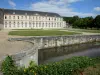
Champ de Bataille Castle
| Municipality | Bosroumois |
|---|---|
| Postcode | 27670 |
| Latitude | 49.2895759 (N 49° 17’ 22”) |
| Longitude | 0.9236070 (E 0° 55’ 25”) |
| Altitude | From 107m to 162m |
| Surface area | 13.24 km² |
| Population | 3786 inhabitants |
| Density | 285 inhabitants/km² |
| Prefecture | Evreux (60 km, 47 min) |
| Insee code | 27090 |
| Intercommunality | CC Roumois Seine |
| Department | Eure |
| Region | Normandy |
| Saint-Ouen-du-Tilleul | 1.9 km (3 min) |
|---|---|
| La Londe | 4.1 km (7 min) |
| Le Thuit de l'Oison | 4.8 km (9 min) |
| Grand Bourgtheroulde | 5.7 km (10 min) |
| Saint-Pierre-du-Bosguérard | 6 km (9 min) |
| La Saussaye | 6.9 km (14 min) |
| Elbeuf | 7.3 km (11 min) |
| Saint-Pierre-des-Fleurs | 7.7 km (13 min) |
| Caudebec-lès-Elbeuf | 8.1 km (14 min) |
| Les Monts du Roumois | 8.2 km (12 min) |
| Orival | 8.6 km (12 min) |
| Saint-Aubin-lès-Elbeuf | 8.8 km (14 min) |
| La Haye-du-Theil | 9 km (11 min) |
| Last name | Activity type | Rate | City |
|---|---|---|---|
 | Entertainment | 40 € | Sotteville-lès-Rouen (18.8 km) |
 | Local flavours | 55 € | Saint-Philbert-des-Champs (47 km) |
 | Nature and the great outdoors | 12 € to 16 € | Saint-Denis-sur-Scie (48 km) |
| Last name | Outing type | Difficulty | Duration | Departure municipality |
|---|---|---|---|---|
 | Cycling itinerary | Athletic | 2:05 | La Bouille (6.8 km) |
 | Hike | Intermediate | 1:10 | Orival (6.9 km) |
 | Hike | Athletic | 3:45 | Sahurs (7.2 km) |
 | Hike | Easy | 35 min | Orival (8.2 km) |
 | Hike | Intermediate | 1:55 | Orival (8.2 km) |