
Favourite
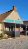
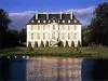
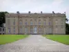
Falaise
| Municipality | Fourches |
|---|---|
| Postcode | 14620 |
| Latitude | 48.8595050 (N 48° 51’ 34”) |
| Longitude | -0.0783770 (W 0° 4’ 42”) |
| Altitude | From 73m to 160m |
| Surface area | 4.78 km² |
| Population | 227 inhabitants |
| Density | 47 inhabitants/km² |
| Prefecture | Caen (58 km, 44 min) |
| Insee code | 14283 |
| Intercommunality | CC du Pays de Falaise |
| Department | Calvados |
| Region | Normandy |
| Vignats | 2.7 km (4 min) |
|---|---|
| Merri | 3 km (5 min) |
| Crocy | 4.4 km (5 min) |
| Ommoy | 4.9 km (8 min) |
| Nécy | 5 km (7 min) |
| Beaumais | 5.3 km (7 min) |
| Brieux | 5.4 km (9 min) |
| Pertheville-Ners | 5.7 km (9 min) |
| La Hoguette | 6.7 km (11 min) |
| Fresné-la-Mère | 7.6 km (9 min) |
| Guêprei | 7.9 km (12 min) |
| Le Marais-la-Chapelle | 8.8 km (11 min) |
| Rônai | 8.8 km (12 min) |
| Last name | Activity type | Rate | City |
|---|---|---|---|
 | Entertainment | 23 € to 84 € | Saint-Pierre-du-Regard (33 km) |
 | Nature and the great outdoors | 8 € | Thury-Harcourt-le-Hom (33 km) |
 | Sports sensations | 12 € to 30 € | Caen (41 km) |
 | Well-being | 60 € to 150 € | Bagnoles de l'Orne Normandie (42 km) |
 | Local flavours | 55 € | Saint-Philbert-des-Champs (47 km) |
| Last name | Outing type | Difficulty | Duration | Departure municipality |
|---|---|---|---|---|
 | Hike | Easy | 3:00 | Asnières (51 km) |
 | Hike | Easy | 2:00 | Villers-sur-Mer (52 km) |