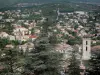
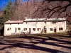


From the village of Cruis, follow the itinerary to Jas de Roche and Notre-Dame de Lure. From the chapel, climb up the GR6 to the summit of Lure. Superb view over the southern Alps, Mont Ventoux and Provence. Follow the ridge eastwards, then descend to the Combe de la Sapée, which leads you back to Cruis via the pretty Jas Neuf.

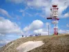
Signal de Lure peak