Liven up your holidays!
Destination
State your preferences
Guide
Plan your stay
Your account
English
Français
Deutsch
Italiano
Español
Nederlands
Português
Русский
简体中文
日本語
0
0
0
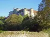
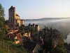
Saint-Cirq-Lapopie
Menu
Tourism
Gastronomy
Outings
Activities
Events
Restaurants
Hotels
Vacation rentals
Bed & breakfasts
Campsites
Holiday insurance
Rental car
Train tickets
Plane tickets
Transfers
Holiday insurance
Holiday insurance
French courses
Romantic weekend
Family weekend
Cheap weekend
Unusual weekend
Find my position
Confirm
Discover
Tourist sites
Gastronomy
Cities & towns
Tourism labels
Themed itineraries
Custom itineraries
Photos
Panoramas
Tourism quiz
Going out
Leisure activities
Outings
Events
Restaurants
Stay
Hotels
Bed & breakfasts
Vacation rentals
Campsites
Travel
Rental car
Train tickets
Plane tickets
Holiday insurance
Information sheets
French courses
Outings
Around Saint-Cirq-Lapopie
Outings in Saint-Cirq-Lapopie
Ideas for walks and hikes in Saint-Cirq-Lapopie
Search
Cancel
22
outings found
Saint-Cirq-Lapopie
Change
Adjust destination
Town centre of Saint-Cirq-Lapopie
Locality - Former locality Cours (Bellefont-La Rauze)
Locality - Former locality Laroque-des-Arcs (Bellefont-La Rauze)
Locality - Former locality Saint-Cernin (Les Pechs du Vers)
Locality - Former locality Saint-Géry (Saint Géry-Vers)
Locality - Former locality Saint-Martin-de-Vers (Les Pechs du Vers)
Locality - Former locality Saint-Sauveur-la-Vallée (Coeur de Causse)
Locality - Former locality Valroufié (Bellefont-La Rauze)
Locality - Former locality Vers (Saint Géry-Vers)
Information point - Tourist Office of Saint-Cirq-Lapopie
Information point - Tourist Office of Cabrerets (Cabrerets)
Information point - Tourist Office of Cahors (Cahors)
Information point - Tourist Office of Lalbenque (Lalbenque)
Information point - Tourist Office of Limogne-en-Quercy (Limogne-en-Quercy)
Information point - Tourist Office of Marcilhac-sur-Célé (Marcilhac-sur-Célé)
Information point - Visitor Information Centre of Cajarc (Cajarc)
Leisure centre - Cave of the Pech Merle (Cabrerets)
Leisure centre - Ecomuseum of Cuzals (Sauliac-sur-Célé)
Leisure centre - Gardens Secrets de Cahors (Cahors)
Leisure centre - Leisure centre of the Île (Tour-de-Faure)
Leisure centre - Museum Henri-Martin (Cahors)
Leisure centre - Museum of Prehistory of Cabrerets (Cabrerets)
Monument - Abbey Saint-Pierre (Marcilhac-sur-Célé)
Monument - Abbey of Lantouy (Saint-Jean-de-Laur)
Monument - Castle of Cajarc (Salvagnac-Cajarc)
Monument - Cathedral Saint-Étienne (Cahors)
Monument - Church Saint-Barthélémy (Cahors)
Monument - Church Saint-Pierre-Liversou (Francoulès)
Monument - Market Hall of Beauregard (Beauregard)
Monument - Wash-house of L'Escabasse (Bach)
Sort by distance from starting point
Sort by difficulty
Sort by change in altitude
Sort by duration
Sort by length in kilometres
Filter results
Open map
Outing type
Hike
Cycling itinerary
Horse ride
Other means of transport
Distance from starting point
Less than 10 km
from 10 km to 30 km
More than 30 km
Difficulty
Easy
Intermediate
Athletic
Change in altitude
Less than 200 m
from 200 m to 500 m
from 500 m to 1000 m
More than 1000 m
Duration
Less than 2 h
from 2 h to 4 h
More than 4 h
Kilometres
Less than 5 km
from 5 km to 10 km
from 10 km to 20 km
More than 20 km
Territory
Massif Central
Midi-Pyrénées
Quercy
Filter results
Hide filters
Open map
Hide map
Outings in Saint-Cirq-Lapopie
Outings around Saint-Cirq-Lapopie
Malecargue Fountain Circuit
8.9
11
Hike in Limogne-en-Quercy
Intermediate
3:15, 10 km (change in altitude 0m)
Perfect walk for understanding the specific features of the Limogne Causse: flora, buildings, characteristics, etc.
Located
11.2 km
away of Saint-Cirq-Lapopie
Favourite
Itinerary
Village of Arcambal along the Lot
6.8
6
Hike in Arcambal
Easy
1:00, 4 km (change in altitude 0m)
Pretty short walk which offers the chance to discover the banks of the Lot and the village of Arcambal with its medieval castle and its church.
Located
12.6 km
away of Saint-Cirq-Lapopie
Favourite
Itinerary
Saint-Cirq-Lapopie - Bouziès
9.3
4
Car itinerary in Arcambal
Easy
5:00, 50 km (change in altitude 0m)
A full-day outing to one of the most beautiful villages in France, the Bouziès towpath and the Quercy Causses.
Located
12.6 km
away of Saint-Cirq-Lapopie
Favourite
Itinerary
8.2
5
All-terrain bike itinerary in Caylus
Intermediate
1:50, 27 km (change in altitude 172m)
Located
27 km
away of Saint-Cirq-Lapopie
Favourite
Itinerary
Labarthe Loop
5.7
7
Hike in Caylus
Easy
1:30, 5 km (change in altitude 310m)
The PR 3 is a short and easy walk ideal for families with young children. It goes around Labarthe Cirque where you will find the Maison du Patrimoine (eco-museum freely accessible) and Caylus Lake. Two woods line the cirque: Labarthe wood and…
Located
27 km
away of Saint-Cirq-Lapopie
Favourite
Itinerary
Henri's path and quest for the magic hammer
9.0
2
Hike in Le Bastit
Easy
2:30, 9 km (change in altitude 141m)
Henri, an inhabitant of Bastit, greatly contributed to the development of this path which today bears his name. Sheep farming has strongly influenced the development of the Causses du Quercy. Thus, the low walls, the caselles and the gariottes…
Located
29 km
away of Saint-Cirq-Lapopie
Favourite
Itinerary
Pressoir needle
9.0
2
Hike in Figeac
Easy
2:00, 5 km (change in altitude 190m)
Discover from Aiguille du Pressoir a magnificent panorama of the city of Art and History of Figeac!
Located
33 km
away of Saint-Cirq-Lapopie
Favourite
Itinerary
Around Malepeyre
7.8
5
Hike in Capdenac-Gare
Easy
1:30, 4 km (change in altitude 50m)
Small easy walk with a low gradient (rising Verdier) on a path of earth and stones. You can contemplate the valley of Saint-Julien in Capdenac High, from the Cross of Verdier. Thank you to respect nature. Good ride!
Located
33 km
away of Saint-Cirq-Lapopie
Favourite
Itinerary
From the Hauts d'Albas
9.3
3
Hike in Albas
Intermediate
3:45, 13 km (change in altitude 170m)
Hiking or mountain biking for views of the valley and vineyards, the variety of combes and their vegetation, the river Lot, the village of Albas and its orientation table. At the highest point of the Croix Girard, magnificent panorama over…
Located
34 km
away of Saint-Cirq-Lapopie
Favourite
Itinerary
Alzou Gorges
8.5
14
Hike in Gramat
Intermediate
5:00, 26 km (change in altitude 250m)
A fantastic walk through the Alzou Canyon, from Gramat to Rocamadour, with ruined old watermills in the heart of the natural surroundings.
Located
35 km
away of Saint-Cirq-Lapopie
Favourite
Itinerary
Circuit of Pochy
8.0
1
Hike in Le Vigan
Easy
2:30, 9 km (change in altitude 204m)
Between valleys and plateaus, a pretty quiet walk offering varied views of the surroundings of the small village of Vigan.
Located
36 km
away of Saint-Cirq-Lapopie
Favourite
Itinerary
Montcuq in Rouillac
8.0
1
Hike in Montcuq-en-Quercy-Blanc
Easy
2:15, 11 km (change in altitude 100m)
Walk with little difficulty with a vertical drop of a hundred meters. To see on the way, the Church of Rouillac made famous for its flat paints on an ocher background.
Located
39 km
away of Saint-Cirq-Lapopie
Favourite
Itinerary
9.0
4
Hike in Gourdon
Easy
2:35, 9 km (change in altitude 109m)
Located
39 km
away of Saint-Cirq-Lapopie
Favourite
Itinerary
Rogations Path
9.0
3
Hike in Roussayrolles
Easy
40 min, 1 km (change in altitude 23m)
On this circuit, you will discover the ancient tradition of "Les Rogations". On 1 May, a procession used to be held around the village, and each of the five crosses was decorated with a white cloth and a sprig of box soaked in holy water. The…
Located
42 km
away of Saint-Cirq-Lapopie
Favourite
Itinerary
Laurélie, Bor and Bar
6.3
5
Village visit in Bor-et-Bar
Easy
3:00, 10 km (change in altitude 200m)
Several solutions, a large loop or a smaller loop. You can leave your car in Bar if you want to follow a short loop, and leave another one in Laurélie, starting point. In Laurélie, climb up (signposted) towards Bor along the path through the…
Located
44 km
away of Saint-Cirq-Lapopie
Favourite
Itinerary
Pech Aguze
5.3
12
Hike in Vaour
Easy
1:00, 5 km (change in altitude 15m)
Louis XIV wall, which encircles Grésigne Forest, is still visible in places and passes a few metres from the La Bouygue estate, and is also very close to the mythical Pech Aguze, the Eagles' Rock, the highest point in the region (491 m).
Located
45 km
away of Saint-Cirq-Lapopie
Favourite
Itinerary
8.6
4
Hike in Duravel
Easy
5:25, 16 km (change in altitude 552m)
Located
47 km
away of Saint-Cirq-Lapopie
Favourite
Itinerary
Around the fortified town of Montcabrier
7.3
7
Hike in Montcabrier
Easy
1:30, 4 km (change in altitude 110m)
A short walk to discover the bastide of Montcabrier and the valley of Thèze.
Located
48 km
away of Saint-Cirq-Lapopie
Favourite
Itinerary
Buffo-Crabo Circuit
8.0
3
Hike in Piquecos
Easy
1:15, 5 km (change in altitude 116m)
This path will take you from the village, perched on the cliff to the banks of the Aveyron. Then he goes back to the village, passing under the castle. The arranged point of view will offer you a moment of rest.
Located
49 km
away of Saint-Cirq-Lapopie
Favourite
Itinerary
Municipality of Tayrac: from the plateau to the valley
7.3
5
Hike in Tayrac
Easy
2:30, 8 km (change in altitude 230m)
A micro region with a complex but very pleasant and attractive relief to be enjoyed when the weather is fine.
Located
53 km
away of Saint-Cirq-Lapopie
Favourite
Itinerary
Puy de Mont Circuit
7.0
7
Hike in Vayrac
Easy
2:00, 7 km (change in altitude 110m)
Walk in the countryside around Vayrac, with viewpoints over the surrounding landscapes and villages.
Located
54 km
away of Saint-Cirq-Lapopie
Favourite
Itinerary
Tescounet Circuit
5.4
5
Hike in La Salvetat-Belmontet
Easy
2:30, 9 km (change in altitude 0m)
Tescounet Circuit, walk in the countryside around the hamlet of St Caprais.
Located
57 km
away of Saint-Cirq-Lapopie
Favourite
Itinerary
See more results
By continuing to browse our site, you are agreeing to the use of cookies to improve your experience and make targeted offers.
Find out more and make settings
Close
Your account
Continue with my email