Liven up your holidays!
Destination
State your preferences
Guide
Plan your stay
Your account
English
Français
Deutsch
Italiano
Español
Nederlands
Português
Русский
简体中文
日本語
0
0
0
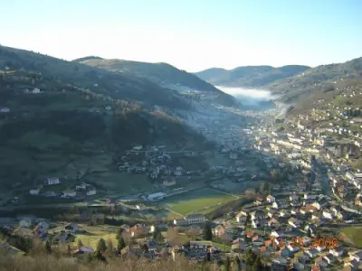
Mélisey
Menu
Tourism
Gastronomy
Outings
Activities
Events
Restaurants
Hotels
Vacation rentals
Bed & breakfasts
Campsites
Holiday insurance
Rental car
Train tickets
Plane tickets
Transfers
Holiday insurance
Holiday insurance
French courses
Romantic weekend
Family weekend
Cheap weekend
Unusual weekend
Find my position
Confirm
Discover
Tourist sites
Gastronomy
Cities & towns
Tourism labels
Themed itineraries
Custom itineraries
Photos
Panoramas
Tourism quiz
Going out
Leisure activities
Outings
Events
Restaurants
Stay
Hotels
Bed & breakfasts
Vacation rentals
Campsites
Travel
Rental car
Train tickets
Plane tickets
Holiday insurance
Information sheets
French courses
Outings
Around Mélisey
Outings in Mélisey
Ideas for walks and hikes in Mélisey
Search
Cancel
43
outings found
Mélisey
Change
Adjust destination
Town centre of Mélisey
Locality - Former locality Miellin (Servance-Miellin)
Locality - Former locality Servance (Servance-Miellin)
Transport - Train station of Champagney (Champagney)
Transport - Train station of Lure (Lure)
Transport - Train station of Ronchamp (Ronchamp)
Information point - Tourist Office of Mélisey
Information point - Tourist Office Rahin et Chérimont (Ronchamp)
Information point - Tourist Office of Faucogney-et-la-Mer (Faucogney-et-la-Mer)
Information point - Tourist Office of Lure (Lure)
Leisure centre - Garden of the Ferrière (Amont-et-Effreney)
Leisure centre - Garden of the Rouges Vis (Frahier-et-Chatebier)
Leisure centre - Leisure Centre of the Saline (Lure)
Leisure centre - Museum of La Montagne (Haut-du-Them-Château-Lambert)
Leisure centre - Museum-Workshop of the Dentelle de Luxeuil (Luxeuil-les-Bains)
Monument - Basilica Saint-Pierre (Luxeuil-les-Bains)
Monument - Castle of La Houillère (Ronchamp)
Monument - Castle of Quers (Quers)
Monument - Castle of Étobon (Étobon)
Monument - Chapel Notre-Dame-du-Haut (Ronchamp)
Monument - House Espagnole (Luxeuil-les-Bains)
Monument - Limestone Kiln of Vouhenans (Vouhenans)
Monument - Monastery of Luxeuil (Luxeuil-les-Bains)
Monument - Priory Saint-Jean-Baptiste d'Annegray (La Voivre)
Monument - Private Mansion Pusel (Luxeuil-les-Bains)
Monument - Private Mansion Thiadot (Luxeuil-les-Bains)
Monument - Wayside Cross of the Église (Vouhenans)
Performance hall - La Chapelle (Ronchamp)
Natural site - Natural Area of the Moulin Saguin (Amage)
Natural site - Nature Reserve of the Tourbière de la Grande Pile (Saint-Germain)
Sort by distance from starting point
Sort by difficulty
Sort by change in altitude
Sort by duration
Sort by length in kilometres
Filter results
Open map
Outing type
Hike
Cycling itinerary
Horse ride
Other means of transport
Distance from starting point
Less than 10 km
from 10 km to 30 km
More than 30 km
Difficulty
Easy
Intermediate
Athletic
Change in altitude
Less than 200 m
from 200 m to 500 m
from 500 m to 1000 m
More than 1000 m
Duration
Less than 2 h
from 2 h to 4 h
More than 4 h
Kilometres
Less than 5 km
from 5 km to 10 km
from 10 km to 20 km
More than 20 km
Territory
Alsace
Franche-Comté
Jura mountains
Lorraine
Filter results
Hide filters
Open map
Hide map
Outings in Mélisey
Outings around Mélisey
Tour of the lake
5.5
28
Hike in Sewen
Easy
1:00, 4 km (change in altitude 0m)
Tour of the village of Sewen and the area around its lake.
Located
25 km
away of Mélisey
Favourite
Itinerary
Lachtelweiher Lake
7.1
18
Hike in Kirchberg
Intermediate
2:30, 6 km (change in altitude 344m)
Family walk with views over the mountain landscapes and Lachtelweiher Lake.
Located
29 km
away of Mélisey
Favourite
Itinerary
3 lakes circuit
7.9
27
Hike in Rimbach-près-Masevaux
Intermediate
4:40, 13 km (change in altitude 580m)
Middle mountain walk at the foot of the Gresson Ridge and the Haute Bers, the two Neuweiher glacial lakes are located on the same fault line as Alfeld Lake. Perches Lake (Strensee in Alsatian) nestles in an ancient glacial cirque at an altitude…
Located
29 km
away of Mélisey
Favourite
Itinerary
Brother Joseph Hermitage Chapel
8.2
16
Hike in Ventron
Intermediate
1:15, 5 km (change in altitude 0m)
Walk through the forest and along the pilgrimage paths signposted with crosses to a listed chapel, built by the inhabitants of Ventron in 1784. The more athletic will be able to access the top of the ski slopes along the many paths.
Located
30 km
away of Mélisey
Favourite
Itinerary
Grand Ventron
6.8
12
Hike in Ventron
Intermediate
2:30, 15 km (change in altitude 572m)
A path that winds through the forest, where you will pass close to a lake, a ferruginous spring, to arrive at the highest point in the village at an altitude of 1,204 m, with a view over some of the Vosges summits, such as the Markstein, the…
Located
30 km
away of Mélisey
Favourite
Itinerary
The Crosery Gorges
7.5
24
Cycling itinerary in Vagney
Easy
3:00, 30 km (change in altitude 200m)
Old railway line (Greenway) made available for hikers and cyclists to use. A magnificent place in the heart of the country, where you can enjoy a breath of fresh air and hear the river and birds.
Located
30 km
away of Mélisey
Favourite
Itinerary
Collet Mansuy
9.0
2
Snowshoe hike in Cornimont
Easy
2:30, 6 km (change in altitude 186m)
This easy route offers some short where you can overlook the wild valley Xoulces and then some in the forest to the place called Le Collet Mansuy.
Located
30 km
away of Mélisey
Favourite
Itinerary
Tour of the historic centre
6.9
8
Village visit in Masevaux-Niederbruck
Easy
1:00, 4 km (change in altitude 0m)
Tour of the historic centre of Masevaux (a free leaflet for this walk is available at the Tourist Office).
Located
31 km
away of Mélisey
Favourite
Itinerary
Sattelboden Chalet
7.7
4
Hike in Masevaux-Niederbruck
Intermediate
3:00, 18 km (change in altitude 0m)
Doller Chalet designed for walkers, open to all throughout the year., no reservations or rentals. A free leaflet is available with the 10 Doller chalets.
Located
31 km
away of Mélisey
Favourite
Itinerary
8.6
7
Hike in Grand-Charmont
Intermediate
35 min, 2 km (change in altitude 8m)
Located
32 km
away of Mélisey
Favourite
Itinerary
Bruscher waterfall and botanical trail
6.5
35
Hike in Ranspach
Intermediate
3:00, 5 km (change in altitude 0m)
Beautiful walk through the woods, forests of pine trees and deciduous trees along paths well signposted by the Club Vosgien. Waterfall, fishing lake, botanical trail and superb view over Ranspach and the Thur valley when you reach Dengelberg Chapel.
Located
35 km
away of Mélisey
Favourite
Itinerary
Lispach Lake
8.9
34
Hike in La Bresse
Easy
1:30, 3 km (change in altitude 50m)
Very good path around the lake which is extremely enjoyable.
Located
35 km
away of Mélisey
Favourite
Itinerary
Panorama over the Beuty Rocks
7.1
17
Hike in La Bresse
Easy
2:30, 7 km (change in altitude 340m)
This family itinerary offers an exceptional point of view over La Bresse and the junction between its two valleys, the Chajoux valley and the Vologne valley.
Located
35 km
away of Mélisey
Favourite
Itinerary
8.4
1
Hike in La Vôge-les-Bains
Intermediate
2:10, 7 km (change in altitude 134m)
Located
36 km
away of Mélisey
Favourite
Itinerary
To the Sources of Saint-Remy
6.5
5
Hike in Saint-Rémy-en-Comté
Intermediate
3:30, 10 km (change in altitude 270m)
Come and discover the natural and cultural heritage treasures of Saint-Remy, a small rural village in Haute-Saône. Various signs will allow you to understand more about the protection and preservation of its environment and its history.
Located
37 km
away of Mélisey
Favourite
Itinerary
The Pissoire Waterfall and Le Haut du Tôt Church
8.4
12
Village visit in Le Tholy
Easy
4:00, 22 km (change in altitude 200m)
A journey through various landscapes, fields, mountains, forest and the Pissoire Waterfall, before arriving at Le Haut du Tôt, which has the tallest church in Vosges. The whole itinerary is marked.
Located
39 km
away of Mélisey
Favourite
Itinerary
8.4
10
Hike in Thann
Intermediate
1:05, 3 km (change in altitude 101m)
Located
40 km
away of Mélisey
Favourite
Itinerary
Reposoir Chapel
6.2
16
Hike in Pays-de-Clerval
Easy
1:00, 5 km (change in altitude 250m)
The 5 km Reposoir Chapel footpath leads through the streets of Old Clerval, and then to the edge of the forest with its beautiful views!
Located
41 km
away of Mélisey
Favourite
Itinerary
Lake Tour of Gérardmer
7.7
42
Hike in Gérardmer
Easy
1:45, 5 km (change in altitude 50m)
Put on your sneakers and go for a complete tour of Lake Gérardmer, passing through various places, with breathtaking views of the lake and its surroundings. The walk takes place most of the time on a pedestrian path that runs along the lake.…
Located
41 km
away of Mélisey
Favourite
Itinerary
On the way to school
9.0
7
Hike in Liézey
Easy
2:00, 4 km (change in altitude 100m)
Small walk of about 2 hours performed by the village school in partnership with the City Council and the Community of Communes of Hauts Rupts Lakes. Follow the cow "Marguerite", it will take you to the most beautiful farms as well as beautiful views.
Located
41 km
away of Mélisey
Favourite
Itinerary
Rangen massif
8.0
1
Hike in Burnhaupt-le-Haut
Intermediate
1:00, 2 km (change in altitude 101m)
The Rangen vineyard is the southernmost in Alsace and the only one in the region to be classified Grand Cru in its entirety. Its hillsides (350 to 450 m), facing due south, extend over an area of 22 ha with slopes of up to 45°. It also owes…
Located
42 km
away of Mélisey
Favourite
Itinerary
9.6
5
Hike in Docelles
Easy
50 min, 3 km (change in altitude 19m)
Located
44 km
away of Mélisey
Favourite
Itinerary
6.5
3
Hike in Ferrières-lès-Scey
Easy
1:05, 4 km (change in altitude 28m)
Located
44 km
away of Mélisey
Favourite
Itinerary
Pont des Fées bridge and Perles de Vologne
8.3
30
Hike in Gérardmer
Easy
1:00, 2 km (change in altitude 12m)
Pretty and easily accessible itinerary along a river, even with a pram. Wooded and very natural environment. After a few hundred metres, the Pont des Fées bridge - a pretty old bridge - spans the river. Continue along the path to reach Perles…
Located
44 km
away of Mélisey
Favourite
Itinerary
Fischboedlé Lake
7.9
37
Hike in Metzeral
Easy
2:00, 4 km (change in altitude 300m)
Visit to Fischboedlé Lake, situated at an altitude of 794 metres, and its surrounding environment.
Located
45 km
away of Mélisey
Favourite
Itinerary
See more results
By continuing to browse our site, you are agreeing to the use of cookies to improve your experience and make targeted offers.
Find out more and make settings
Close
Your account
Continue with my email