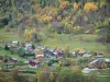
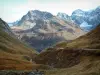
This trail combines paths going around the mountainside and mainly goes downwards, passing through the forest to link the two highest villages in the ski resort.
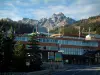
Courchevel

This trail combines paths going around the mountainside and mainly goes downwards, passing through the forest to link the two highest villages in the ski resort.
| Department | Savoie |
|---|---|
| Departure municipality | Courchevel |
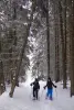
| Outing type | Snowshoe hike |
| Difficulty | Intermediate |
| Duration | 1:30 |
| Kilometres | 3 km |
| Altitude upon departure | 1565m |
| Change in altitude | 139m |
Depart from the town of Courchevel, latitude 45.4147300 (N 45° 24’ 53”), longitude 6.6344300 (E 6° 38’ 4”)