Visit the village, its territory and surroundings.
Poix-de-Picardie
Visit the village, its territory and surroundings.

| Department | Somme |
|---|---|
| Departure municipality | Courcelles-sous-Moyencourt |
| Outing type | Hike |
| Difficulty | Easy |
| Duration | 3:00 |
| Recommended period | from january to december |
| Kilometres | 10 km |
| Altitude upon departure | 162m |
| Change in altitude | 65m |
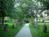
Square of Courcelles-sous-Moyencourt. Highest point of the village.
From the square (sieve set) Courcelles-sous-Moyencourt, pass the area of the Montaigneraie and the calvary of the fifteenth century and take the street Jacquet. At the end of the street, turn left and follow the arboretum of the castle.
Take right and along the road the wood of Cramesnil then left down the path of La Motte. To the right continue the path of the valley of Fresnoy.
Take the road on the right to reach the village of Courcelles-sous-Moyencourt. Continue straight at the intersection on rue de la Vallée. Always straight on the next crossing, along the wood of Mount Foucart on the way to Moyencourt (GR 125). At the end of the road, turn right on Rue Delattre.
Opposite the church, cross the village of Moyencourt along the Grande Rue and then turn right onto Rue d'Ostende. After leaving the village and join the crossing going from Courcelles to Croixrault take the road on the left and the first path on the right. At the end of the path, turn right, follow the A29 then the Bois de la Couture. At the bridge, right and left, cross the valley of the Polacres and right again to get behind the park of the castle.
Back in the village, turn right on the Rue des Vignes then left the Chemin des Vignes. Go left on the small path to go up to the pond facing the main entrance of the castle.