


Favourite
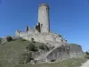
The Saint-Amant-de-Boixe abbey
| Municipality | Vouharte |
|---|---|
| Postcode | 16330 |
| Tourism label | ") |
| Latitude | 45.8152500 (N 45° 48’ 55”) |
| Longitude | 0.0731860 (E 0° 4’ 23”) |
| Altitude | From 42m to 137m |
| Surface area | 10.64 km² |
| Population | 328 inhabitants |
| Density | 30 inhabitants/km² |
| Prefecture | Angoulême (23 km, 27 min) |
| Insee code | 16419 |
| Intercommunality | CC Cœur de Charente |
| Department | Charente |
| Territory | Charentes |
| Region | New-Aquitaine |
| Xambes | 3 km (5 min) |
|---|---|
| La Chapelle | 3.8 km (5 min) |
| Coulonges | 5.1 km (7 min) |
| Vervant | 5.1 km (10 min) |
| Marcillac-Lanville | 5.5 km (6 min) |
| Montignac-Charente | 5.9 km (7 min) |
| Genac-Bignac | 6.2 km (9 min) |
| Villognon | 6.5 km (13 min) |
| Saint-Amant-de-Boixe | 7.5 km (9 min) |
| Ambérac | 8.2 km (10 min) |
| Vars | 8.2 km (12 min) |
| Mons | 10.3 km (14 min) |
| Aigre | 11.2 km (13 min) |
| Villejoubert | 11.3 km (13 min) |
| Maine-de-Boixe | 11.3 km (15 min) |
| Last name | Activity type | Rate | City |
|---|---|---|---|
 | Local flavours | Free | Graves-Saint-Amant (23 km) |
 | Entertainment | 52 € to 84 € | La Rochefoucauld-en-Angoumois (25 km) |
 | Sports sensations | 10 € to 20 € | Saint-Bris-des-Bois (42 km) |
| Last name | Outing type | Difficulty | Duration | Departure municipality |
|---|---|---|---|---|
 | Hike | Easy | 1:00 | Mons (8.8 km) |
 | Village visit | Easy | 1:30 | Bunzac (25 km) |
| Hike | Easy | 1:30 | Eymouthiers (41 km) |
 | Hike | Easy | 2:30 | Vendoire (48 km) |
 | Hike | Easy | 4:00 | Saint-Estèphe (52 km) |