
Favourite
The Maginot Line
| Municipality | Villing |
|---|---|
| Postcode | 57550 |
| Latitude | 49.2814650 (N 49° 16’ 53”) |
| Longitude | 6.6305440 (E 6° 37’ 50”) |
| Altitude | From 240m to 366m |
| Surface area | 4.93 km² |
| Population | 513 inhabitants |
| Density | 104 inhabitants/km² |
| Prefecture | Metz (46 km, 42 min) |
| Insee code | 57720 |
| Intercommunality | CC Houve-Pays Boulageois |
| Department | Moselle |
| Territory | Lorraine |
| Region | Great East |
| Voelfling-lès-Bouzonville | 2.6 km (5 min) |
|---|---|
| Château-Rouge | 3 km (5 min) |
| Rémering | 3.1 km (6 min) |
| Berviller-en-Moselle | 3.2 km (7 min) |
| Oberdorff | 4.1 km (6 min) |
| Tromborn | 4.7 km (5 min) |
| Merten | 5.4 km (9 min) |
| Heining-lès-Bouzonville | 5.5 km (11 min) |
| Brettnach | 7.2 km (12 min) |
| Alzing | 7.8 km (11 min) |
| Dalem | 8.2 km (11 min) |
| Falck | 8.3 km (13 min) |
| Téterchen | 8.5 km (8 min) |
| Bouzonville | 10 km (12 min) |
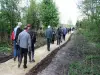
| Last name | Outing type | Difficulty | Duration | Departure municipality |
|---|---|---|---|---|
 | Hike | Easy | 2:00 | Berviller-en-Moselle (1.8 km) |
 | Hike | Easy | 30 min | Ham-sous-Varsberg (11.4 km) |
 | Cycling itinerary | Easy | 4:30 | Frauenberg (40 km) |
| Cycling itinerary | Easy | 4:00 | Lorentzen (54 km) |
| Hike | Easy | 2:00 | Diemeringen (56 km) |