
Favourite
Troyes
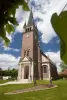
| Municipality | Villeloup |
|---|---|
| Postcode | 10350 |
| Latitude | 48.3602050 (N 48° 21’ 37”) |
| Longitude | 3.8742490 (E 3° 52’ 27”) |
| Surface area | 16.31 km² |
| Population | 130 inhabitants |
| Density | 7 inhabitants/km² |
| Prefecture | Troyes (21 km, 21 min) |
| Insee code | 10414 |
| Intercommunality | CA Troyes Champagne Métropole |
| Department | Aube |
| Territory | Champagne-Ardenne |
| Region | Great East |
| Le Pavillon-Sainte-Julie | 2.4 km (3 min) |
|---|---|
| Échemines | 4.3 km (7 min) |
| Dierrey-Saint-Pierre | 5.5 km (5 min) |
| Dierrey-Saint-Julien | 7.4 km (7 min) |
| Savières | 8.6 km (12 min) |
| Payns | 8.8 km (10 min) |
| Fontaine-les-Grès | 9.4 km (11 min) |
| Villacerf | 10 km (11 min) |
| Saint-Flavy | 10.5 km (11 min) |
| Saint-Lyé | 10.8 km (11 min) |
| Prunay-Belleville | 11.1 km (11 min) |
| Faux-Villecerf | 11.6 km (14 min) |
| Mergey | 12 km (14 min) |
| Last name | Outing type | Difficulty | Duration | Departure municipality |
|---|---|---|---|---|
 | All-terrain bike itinerary | Easy | 3:40 | Estissac (11.5 km) |
 | Cycling itinerary | Easy | 5:05 | Estissac (11.7 km) |
 | Hike | Easy | 50 min | Troyes (16.6 km) |
 | Hike | Easy | 2:10 | Troyes (16.6 km) |
 | Hike | Easy | 3:20 | Bercenay-en-Othe (16.9 km) |