


Favourite
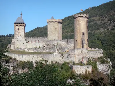
Foix
| Municipality | Vernajoul |
|---|---|
| Postcode | 09000 |
| Latitude | 42.9857350 (N 42° 59’ 9”) |
| Longitude | 1.6056440 (E 1° 36’ 20”) |
| Altitude | From 359m to 724m |
| Surface area | 9.08 km² |
| Population | 718 inhabitants |
| Density | 79 inhabitants/km² |
| Prefecture | Foix (3.2 km, 7 min) |
| Insee code | 09329 |
| Intercommunality | CA Pays Foix-Varilhes |
| Department | Ariège |
| Territories | Midi-Pyrénées, Pyrenees |
| Region | Occitanie |
| Foix | 3.2 km (6 min) |
|---|---|
| Saint-Jean-de-Verges | 3.5 km (6 min) |
| Loubières | 3.9 km (6 min) |
| Ferrières-sur-Ariège | 6 km (12 min) |
| Crampagna | 6.1 km (8 min) |
| Cos | 6.5 km (10 min) |
| Saint-Pierre-de-Rivière | 7.3 km (12 min) |
| Varilhes | 7.5 km (11 min) |
| Ganac | 7.6 km (14 min) |
| Baulou | 7.6 km (11 min) |
| Montgailhard | 7.9 km (13 min) |
| Prayols | 8.2 km (14 min) |
| Dalou | 8.7 km (11 min) |
| Saint-Martin-de-Caralp | 9.1 km (11 min) |
| Last name | Activity type | Rate | City |
|---|---|---|---|
 | Nature and the great outdoors | 75 € to 576 € | Camarade (29 km) |
| Last name | Outing type | Difficulty | Duration | Departure municipality |
|---|---|---|---|---|
 | Hike | Easy | 4:00 | La Bastide-de-Sérou (14.8 km) |
 | Mountain bike itinerary | Intermediate | 8:00 | Mirepoix (25 km) |
 | Hike | Intermediate | 2:00 | Belloc (27 km) |
 | Hike | Intermediate | 3:30 | Roquefeuil (37 km) |
 | Village visit | Intermediate | 2:00 | Carbonne (46 km) |