
Favourite
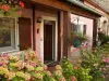
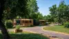
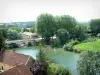
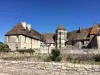
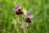
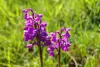
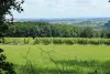
The Saône Valley
| Municipality | Velloreille-lès-Choye |
|---|---|
| Postcode | 70700 |
| Latitude | 47.3933840 (N 47° 23’ 36”) |
| Longitude | 5.7359910 (E 5° 44’ 10”) |
| Altitude | From 209m to 262m |
| Surface area | 4.13 km² |
| Population | 84 inhabitants |
| Density | 20 inhabitants/km² |
| Prefecture | Vesoul (46 km, 43 min) |
| Insee code | 70540 |
| Intercommunality | CC des Monts de Gy |
| Department | Haute-Saône |
| Territory | Franche-Comté |
| Region | Burgundy-Franche-Comté |
| Villefrancon | 1.6 km (4 min) |
|---|---|
| Choye | 2.5 km (5 min) |
| Cugney | 3.5 km (9 min) |
| Saint-Loup-Nantouard | 4.6 km (9 min) |
| Charcenne | 5 km (10 min) |
| Velesmes-Échevanne | 5.2 km (8 min) |
| Gy | 6.8 km (10 min) |
| Venère | 7.6 km (15 min) |
| Onay | 8.2 km (12 min) |
| Sauvigney-lès-Gray | 8.4 km (15 min) |
| Saint-Broing | 8.7 km (14 min) |
| Avrigney-Virey | 9.5 km (15 min) |
| Champtonnay | 9.8 km (15 min) |
| Bucey-lès-Gy | 10.2 km (12 min) |
| Last name | Activity type | Rate | City |
|---|---|---|---|
 | Entertainment | 84 € to 110 € | Besançon (28 km) |
 | Sports sensations | 99 € to 299 € | Dole (45 km) |
| Last name | Outing type | Difficulty | Duration | Departure municipality |
|---|---|---|---|---|
 | Hike | Intermediate | 3:10 | Gy (5.9 km) |
 | Hike | Easy | 1:50 | Gy (5.9 km) |
 | Hike | Intermediate | 2:30 | Gy (5.9 km) |
 | Hike | Easy | 2:35 | Bucey-lès-Gy (8.5 km) |
 | Hike | Intermediate | 1:20 | Bucey-lès-Gy (9 km) |