

Favourite
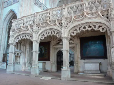
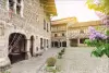
Brou Royal Monastery
| Municipality | Tossiat |
|---|---|
| Postcode | 01250 |
| Latitude | 46.1396780 (N 46° 8’ 23”) |
| Longitude | 5.3168330 (E 5° 19’ 1”) |
| Altitude | From 244m to 501m |
| Surface area | 10.17 km² |
| Population | 1390 inhabitants |
| Density | 136 inhabitants/km² |
| Prefecture | Bourg-en-Bresse (13.1 km, 18 min) |
| Insee code | 01422 |
| Intercommunality | CA du Bassin de Bourg-en-Bresse |
| Department | Ain |
| Territories | Alps, Jura mountains |
| Region | Auvergne-Rhône-Alps |
| Journans | 1.5 km (4 min) |
|---|---|
| Revonnas | 3.4 km (5 min) |
| Certines | 4.4 km (6 min) |
| Saint-Martin-du-Mont | 4.9 km (7 min) |
| Montagnat | 4.9 km (8 min) |
| Ceyzériat | 5.3 km (8 min) |
| La Tranclière | 7 km (10 min) |
| Jasseron | 9 km (14 min) |
| Villereversure | 9.3 km (12 min) |
| Bohas-Meyriat-Rignat | 9.4 km (13 min) |
| Saint-Just | 9.4 km (13 min) |
| Bohas | 9.5 km (13 min) |
| Ramasse | 9.6 km (15 min) |
| Lent | 10.4 km (12 min) |
| Transport |
|---|
| Last name | Activity type | Rate | City |
|---|---|---|---|
 | Entertainment | 17 € | Pérouges (28 km) |
 | Culture and education | 36 € | Pérouges (28 km) |
 | Sports sensations | 37 € | Joudes (36 km) |
| Last name | Outing type | Difficulty | Duration | Departure municipality |
|---|---|---|---|---|
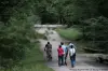 | Hike | Easy | 1:10 | Péronnas (7.9 km) |
 | Hike | Easy | 55 min | Serrières-sur-Ain (10.1 km) |
 | Hike | Intermediate | 4:45 | Bolozon (13.5 km) |
 | Hike | Easy | 40 min | Matafelon-Granges (15.7 km) |
 | Hike | Easy | 2:35 | Nurieux-Volognat (16.4 km) |


